Current Issue

2026 Vol. 44, No. 1

Display Method:
2026, 44(1): .
Abstract(49) HTML (37) PDF(17)
Abstract:
A Survey on Wireless Channel Characteristics for Intelligent Inland Shipping: Measurement and Modeling Techniques
ZHANG Jing, HU Wenfei, ZHANG Qingyang, LI Changzhen, CHEN Mozi, CHEN Mengda
2026, 44(1): 1-12. doi: 10.3963/j.jssn.1674-4861.2026.01.001
Abstract(97) HTML (39) PDF(15)
Abstract:
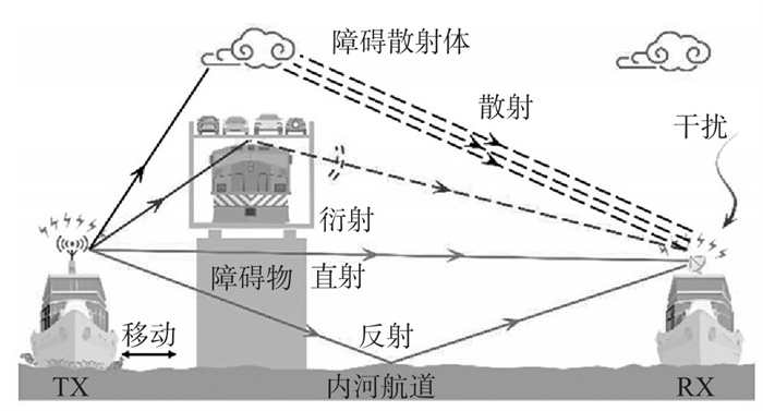
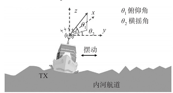
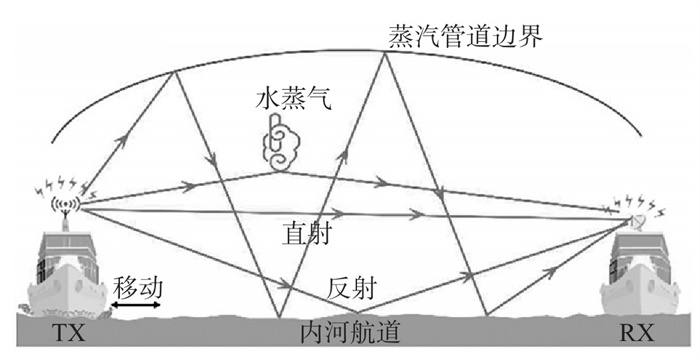
As intelligent shipping systems continue to develop rapidly, efficient and reliable wireless communications become one of the key enabling technologies for supporting vessel state sensing, waterway environmental monitoring, and collaborative operations. Based on the existing body of research, this paper reviews recent advances in wireless channel characterization for intelligent inland shipping and highlights the unique challenges that distinguish inland waterways from terrestrial and near-shore environments, including corridor-like wide-area coverage induced by complex land-water mixed topologies, navigation environments and natural conditions, and dense man-made structures (e.g., bridges) and other obstructions. Representative inland waterways worldwide are examined, and by analyzing the adaptability bottlenecks of current communication technologies in inland scenarios, it is shown that conventional channel models cannot accurately capture the propagation mechanisms specific to inland waterways. The review focuses on two core aspects: channel measurement and channel modeling, while also summarizing differences across typical frequency bands and waterway segments, comparing the applicability boundaries of statistical and geometry-based modeling approaches, and outlining key procedures for parameter acquisition and validation to inform future research. On the measurement side, three major characteristics are identified, namely the sparsity of air-space-water links, the instability caused by vessel motion, and evaporation-duct effects; the limitations of existing measurement schemes are then discussed in terms of dynamic trajectory tracking, localized meteorological coupling, and high-resolution capture of non-line-of-sight paths. On the modeling side, large-scale and small-scale fading models applicable to inland environments are reviewed, and the limitations of existing models in finely characterizing the coupled dynamics of vessel-induced motion and time-varying water-surface reflections, as well as constrained scenarios such as bridge canyons, are emphasized. Finally, building a highly reliable communication network with full-coverage capability for inland waterways calls for breakthroughs in environment-driven high-fidelity channel modeling, multi-band propagation mechanism analysis, and the design of coordinated "shore-ship-cloud" architectures.
A Modeling Method of Large Language Model-based Decision-making Agents for Maritime Search and Rescue
SUO Yongfeng, LUO Fangfang, CUI Lei, WANG Jianming, PAN Xueqing
2026, 44(1): 13-25. doi: 10.3963/j.jssn.1674-4861.2026.01.002
Abstract(69) HTML (25) PDF(11)
Abstract:
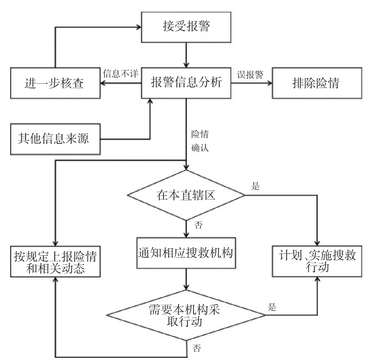
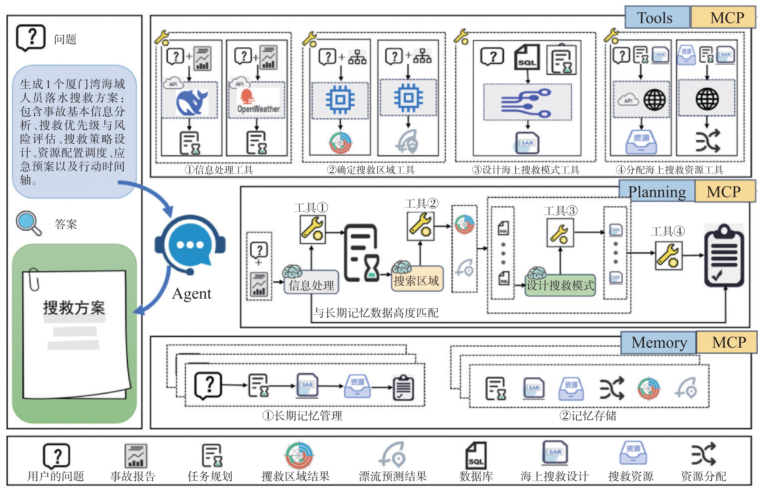
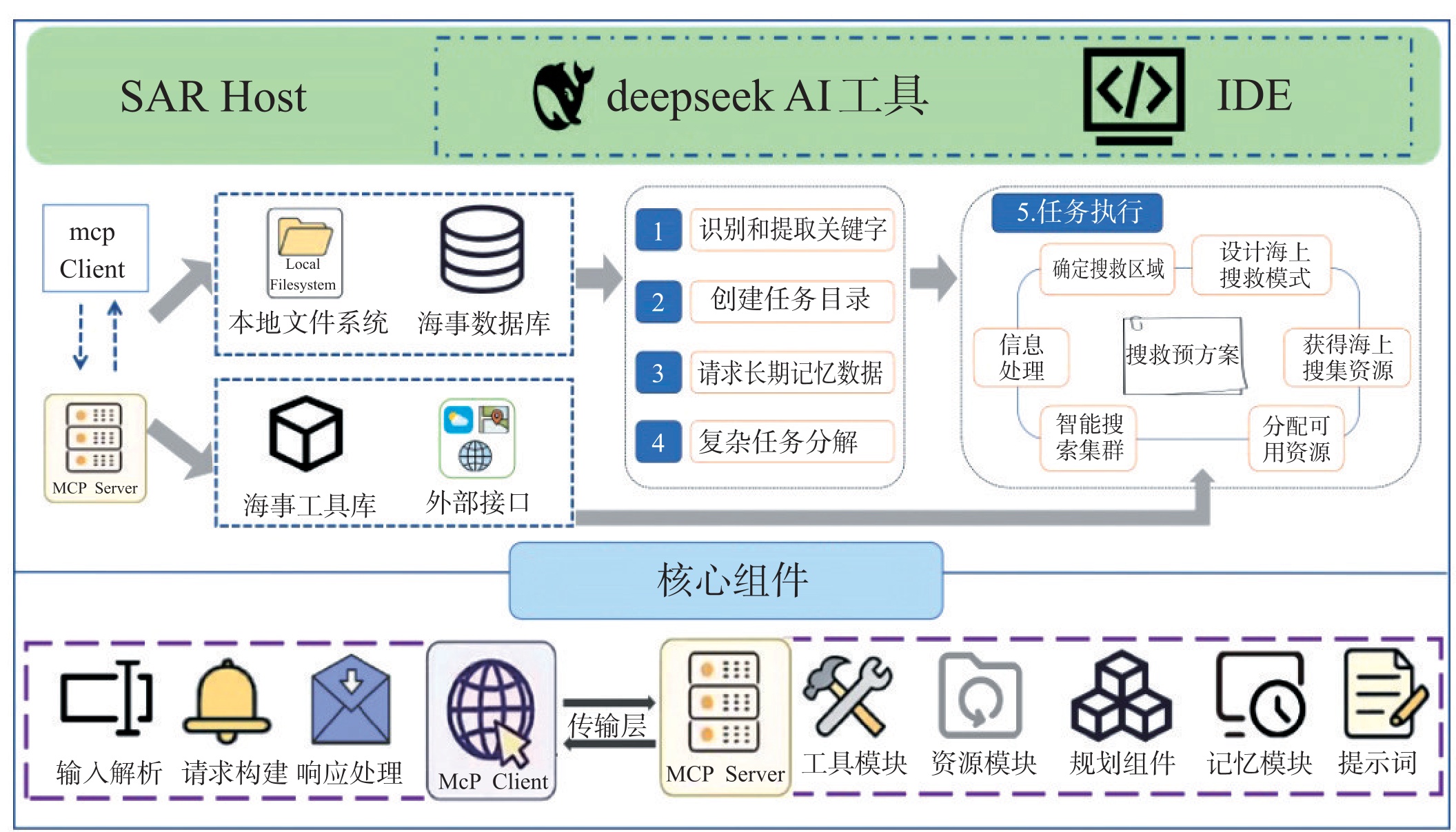
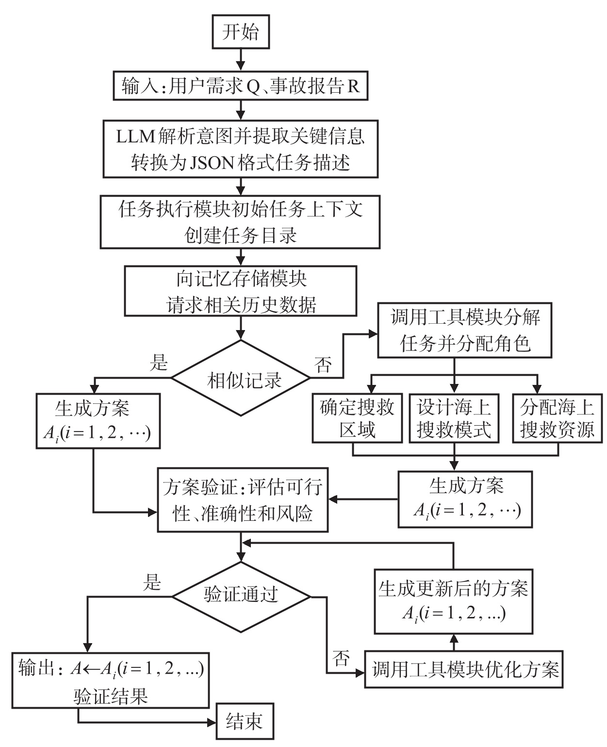
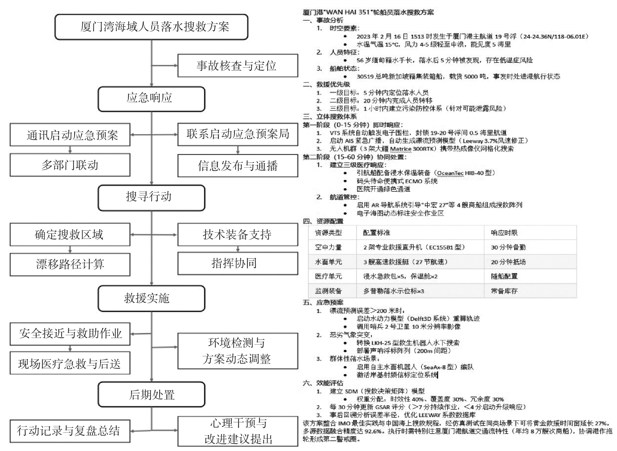
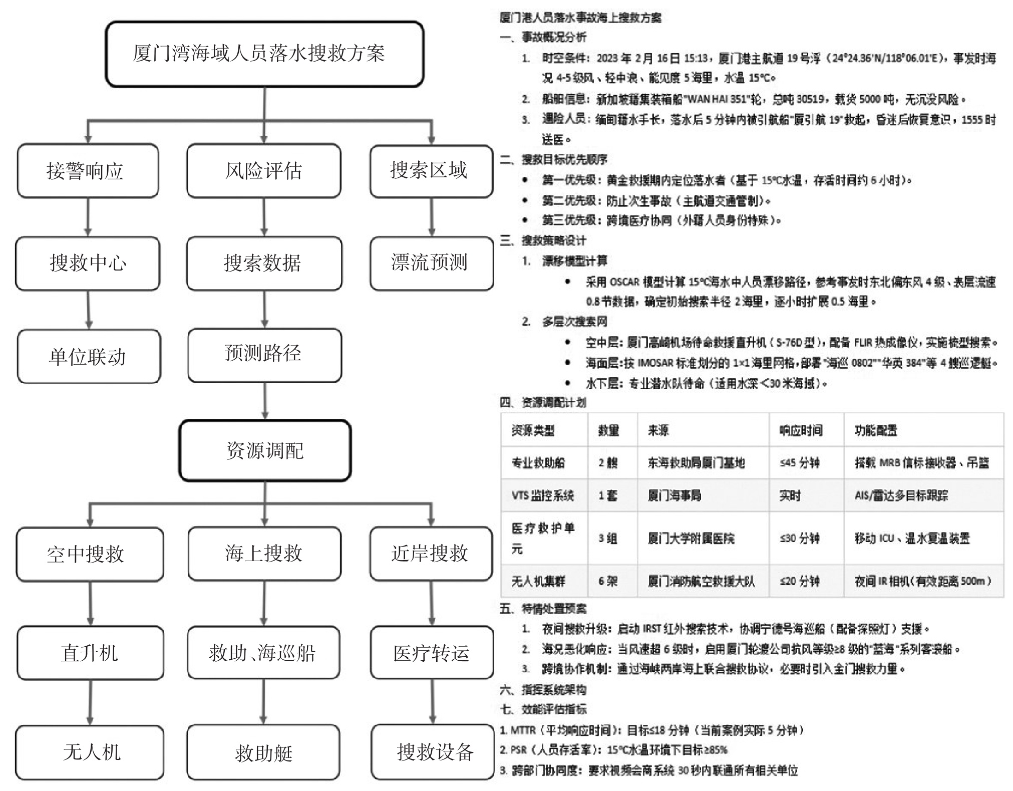
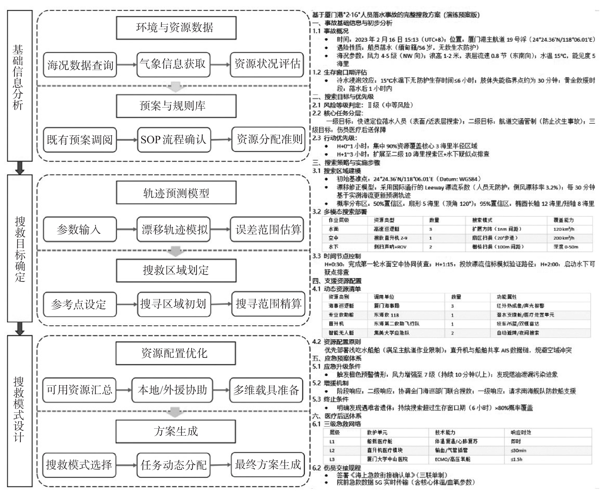
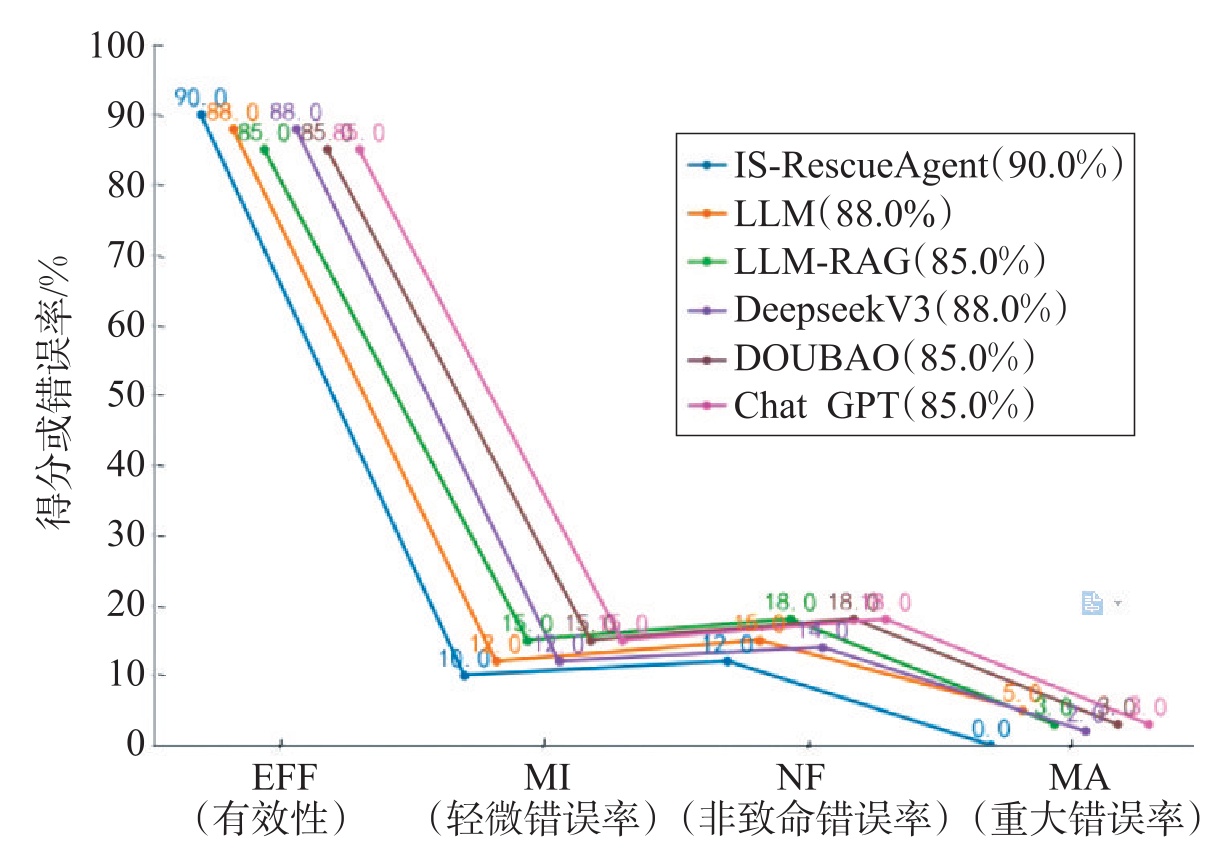
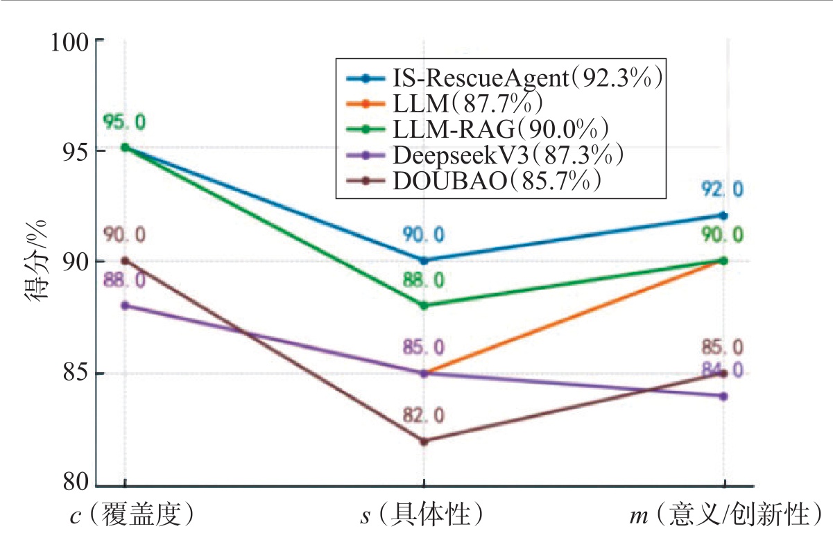
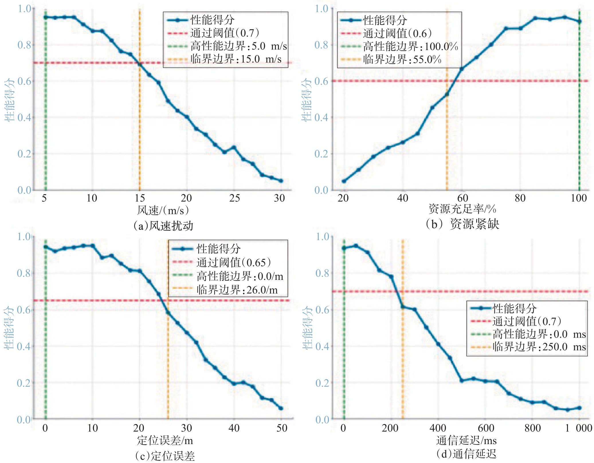
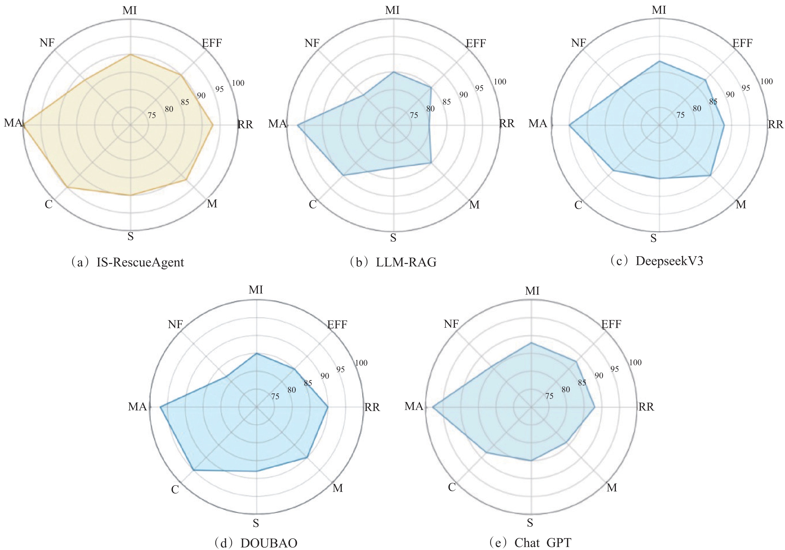
Current maritime search and rescue (SAR) decision-making faces challenges in unified semantic modeling for multi-source heterogeneous information. This deficiency hinders joint reasoning across cross-modal data. Meanwhile, SAR missions involve multi-objective constraints with significant coupling between disparate decision goals. Traditional methods often rely on stage-wise or heuristic-driven processing. They lack the capacity for holistic reasoning and dynamic optimization within the multi-objective decision-making process.To address these challenges, this paper investigates a modeling methodology for the intelligent search and rescue agent (IS-RescueAgent), This agent utilizes a large language model (LLM) as the core reasoning engine. By implementing the model context protocol (MCP), the framework achieves semantic-level coordination of cross-modal information. It executes closed-loop reasoning and multi-objective optimization within a unified process. Through collaborative mechanisms like problem identification and information parsing, the agent achieves fusion of cross-modal data.This includes distress messages, environmental data, and historical records.It also enables dynamic optimization for vessel scheduling, search paths, and task priorities.Architecturally, the proposed agent comprises three stages: First, the information processing stage achieves unified representation of cross-modal features through semantic extraction and intent recognition.Second, The strategy generation stage constructs a multi-objective optimization framework for scenario-adaptive plan generation. Finally, the learning stage establishes an iterative mechanism through performance feedback and parameter updates.Experimental results show that IS-RescueAgent achieves a relevance of 93%, an accuracy of 92%, and a rationality of 92.3%. These metrics outperform traditional LLM and Retrieval-Augmented Generation (RAG) approaches. Furthermore, the system demonstrates strong stability under environmental disturbances. Under conditions of wind speeds below 10 m/s and resource availability above 70%, error rates remain within 5%. The system also maintains high response efficiency with positioning errors under 10 m and communication delays below 200 ms.
A Quantitative Prioritization Assessment Method for Autonomous Vehicle ODD Extension Based on Interpretable Machine Learning
LI Ye, HUANG Qijun, JIN Jieling, TIAN Shan, LI Jipu
2026, 44(1): 26-36. doi: 10.3963/j.jssn.1674-4861.2026.01.003
Abstract(68) HTML (23) PDF(10)
Abstract:
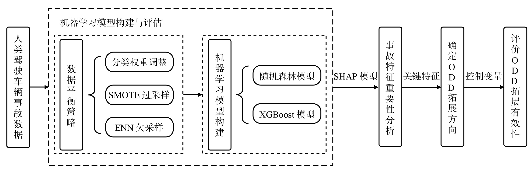
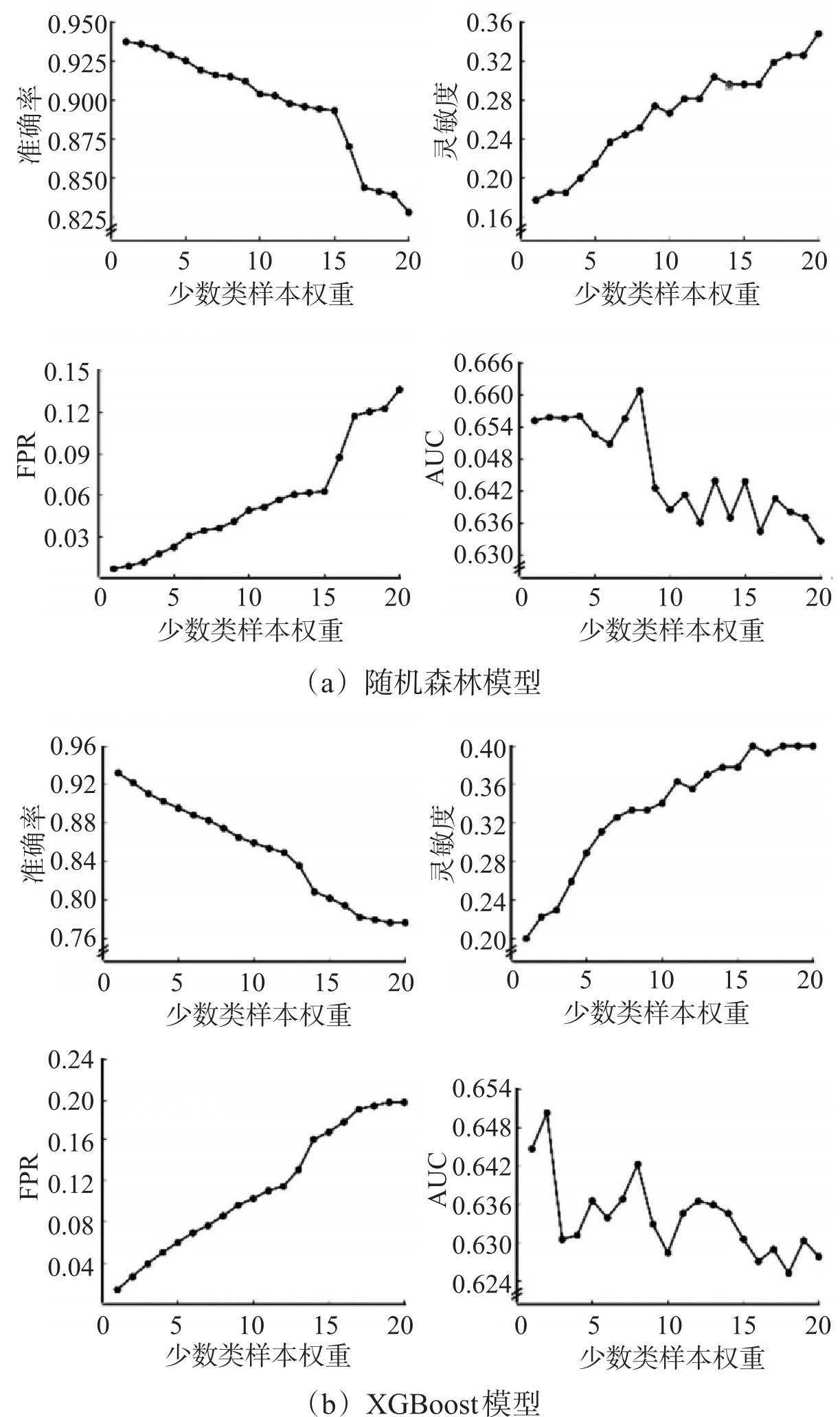
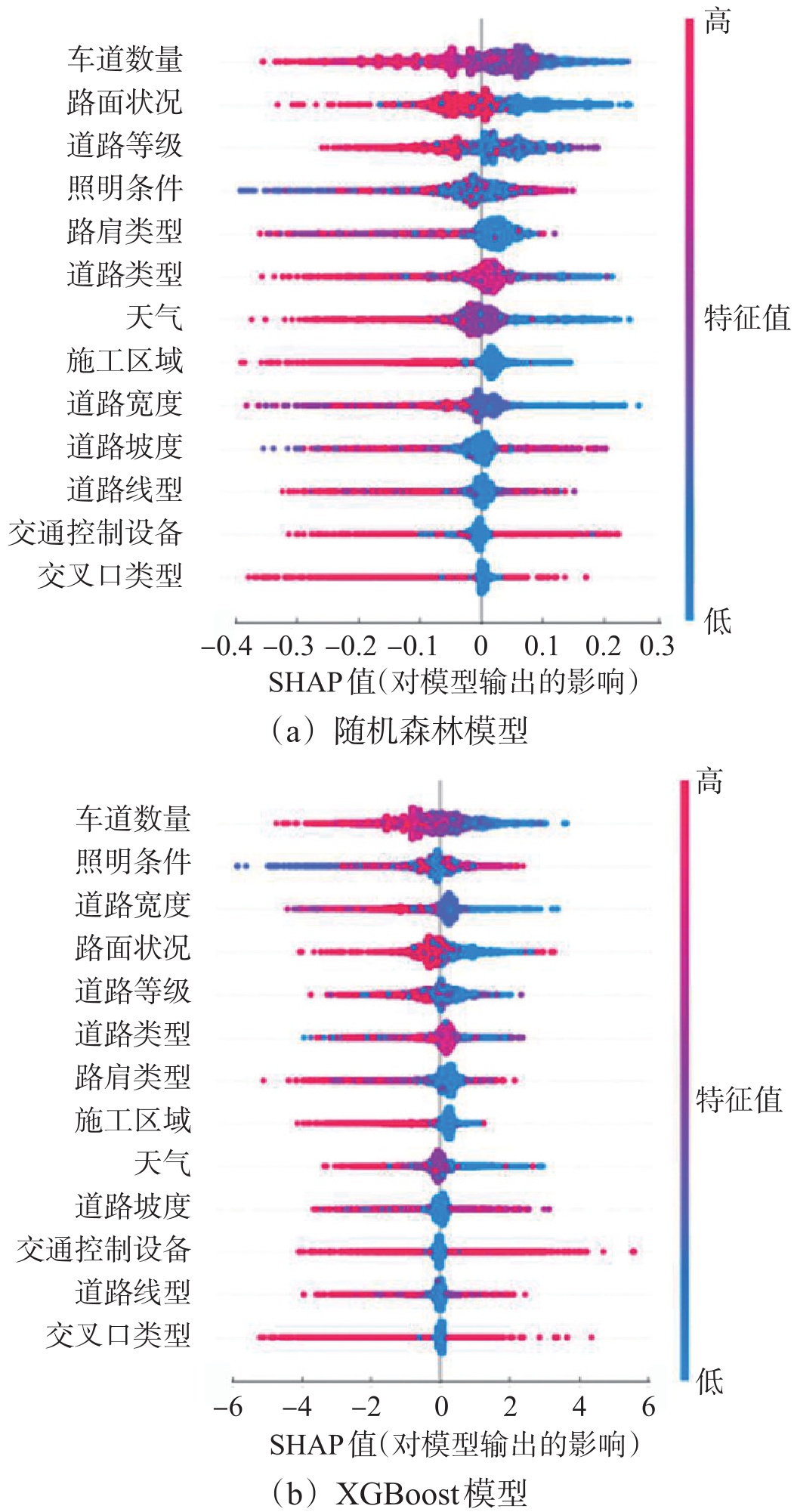
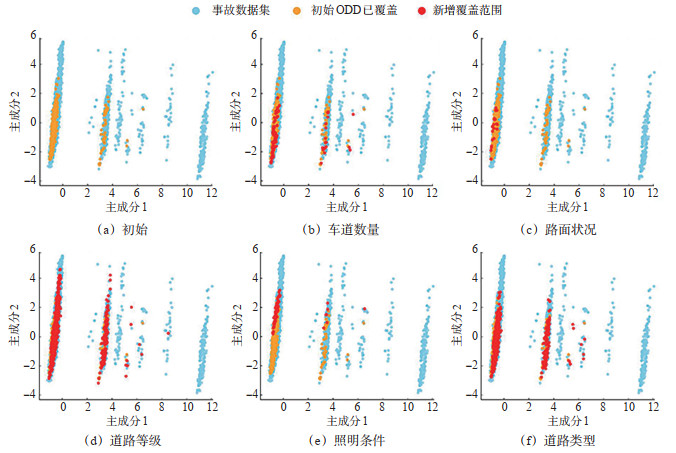
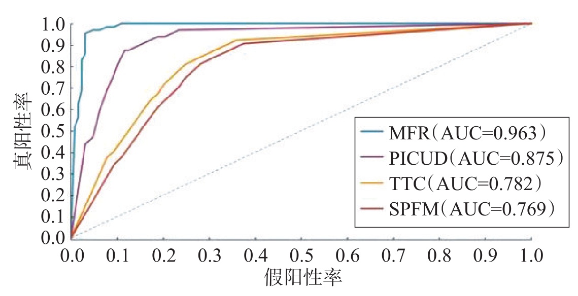
To solve the path ambiguity and decision subjectivity in operational design domain (ODD) extension, a crash data-driven quantitative prioritization assessment framework is investigated. Data support and decision bases for safety capability iterations of autonomous driving systems in complex environments are provided by this framework. To address the long-tail distribution defect of severe crash samples, random forest and extreme gradient boosting (XGBoost) classification models are constructed. The synthetic minority over-sampling technique (SMOTE) is introduced to optimize the sample distribution. The dataset is rebalanced at a 1:20 classification weight ratio to ensure the identification capability for critical minority samples like severe crashes. To break the "black box" limitation of traditional models, the Shapley additive explanations (SHAP) method is employed to deconstruct internal decision-making mechanisms. Furthermore, the nonlinear effect thresholds of environmental feature variables on crash severity are quantified. A marginal effect model for ODD extension is established based on the control variates method and principal component analysis (PCA). By simulating the boundary expansion of a single ODD variable, the improvement in theoretical crash coverage under various extension strategies is calculated. The results indicate that the identification performance of classification models for critical severe crash samples is significantly enhanced after SMOTE processing. While an 83.4% overall accuracy is maintained, the sensitivity of the random forest model is increased from 17.8% to 90.5%. The area under the receiver operating characteristic (ROC) curve (AUC) is increased to 0.922, and high-risk features are captured more precisely. The highest marginal safety benefit among candidate dimensions is yielded by extending to unstructured road grades, as revealed by quantitative data. Theoretical coverage of ordinary and severe crashes is significantly increased by 15.7% and 13.0%, respectively, when expanding ODD from structured highways to state and county roads. Vehicle collision rates under emergency braking in extended scenarios like low road friction and low illumination are verified by CARLA simulation experiments. It is observed that collision rates are increased from 5.0% in the baseline group to 45.0% and 20.0%, respectively. Meanwhile, the average time to collision (TTC) is shortened by 1.3 seconds. The physical safety performance degradation trend is highly consistent with the high-risk feature ranking derived from the quantitative assessment model. It is proven by these quantitative indicators that the priority ODD extension direction with the greatest safety value is reliably identified by the proposed framework.
Adaptive-grid-based Risk Modeling for Left-turn Vehicle-pedestrian Interactions from Aerial Photography Data
AI Yi, WANG Kai, LIAO Xingguo, LIU Fei, HAN Xun, XU Ningxia
2026, 44(1): 37-51. doi: 10.3963/j.jssn.1674-4861.2026.01.004
Abstract(55) HTML (27) PDF(9)
Abstract:
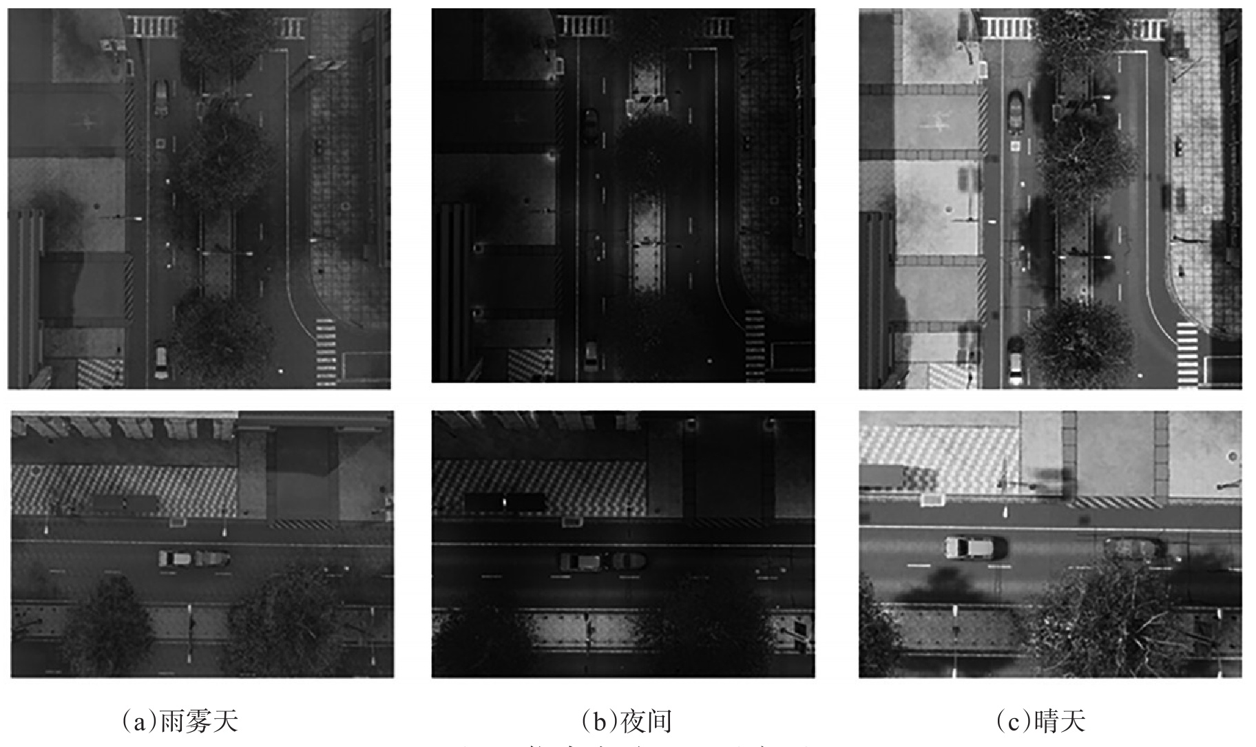
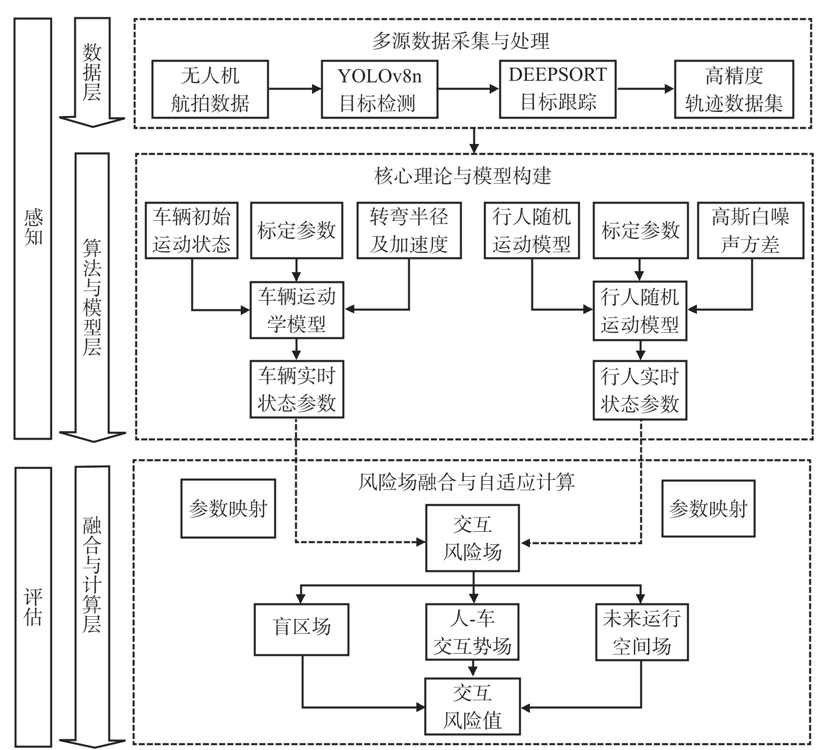
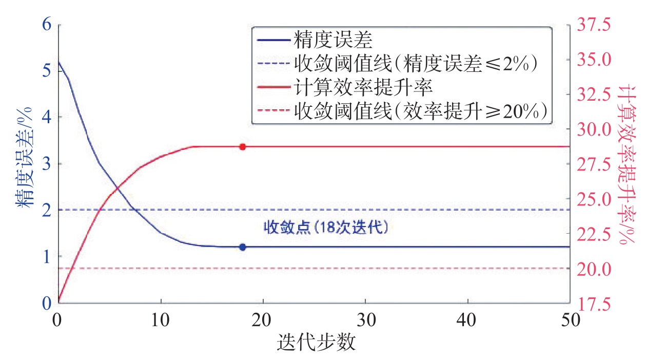
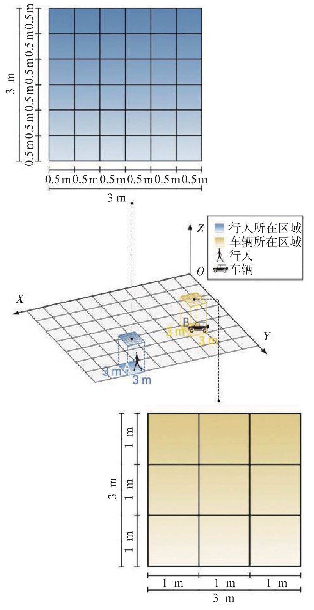
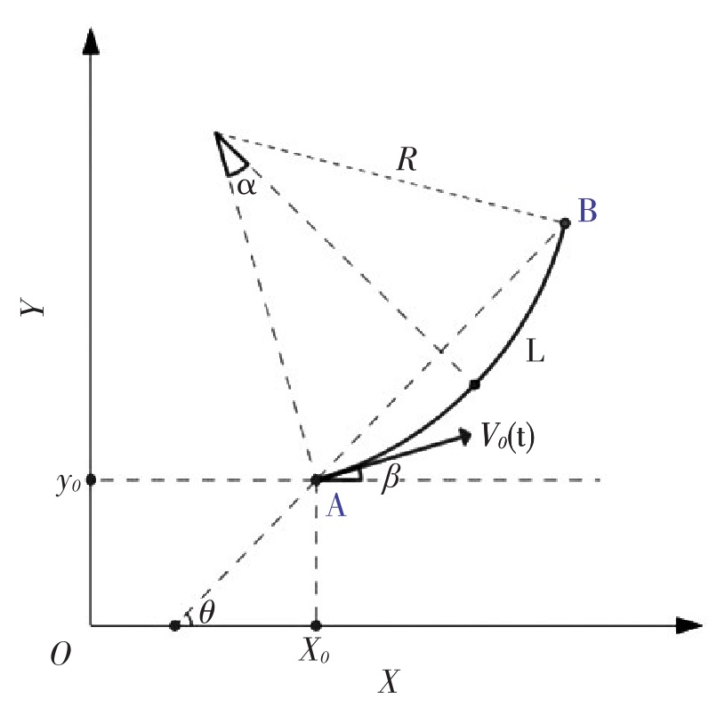
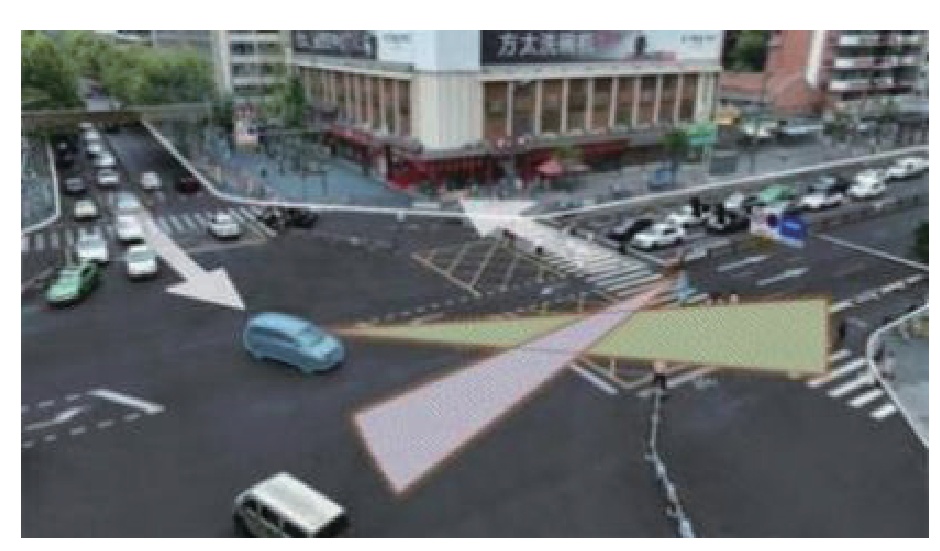
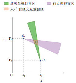
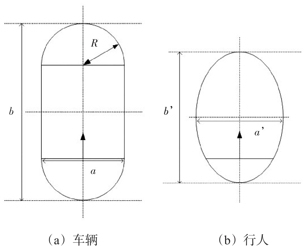
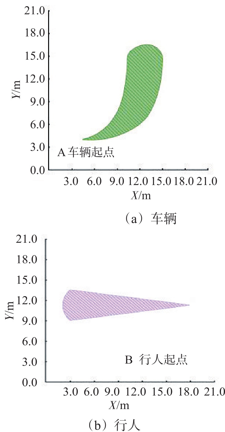
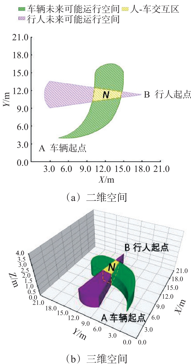
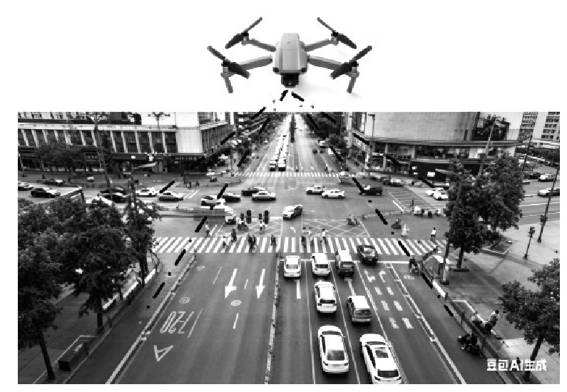
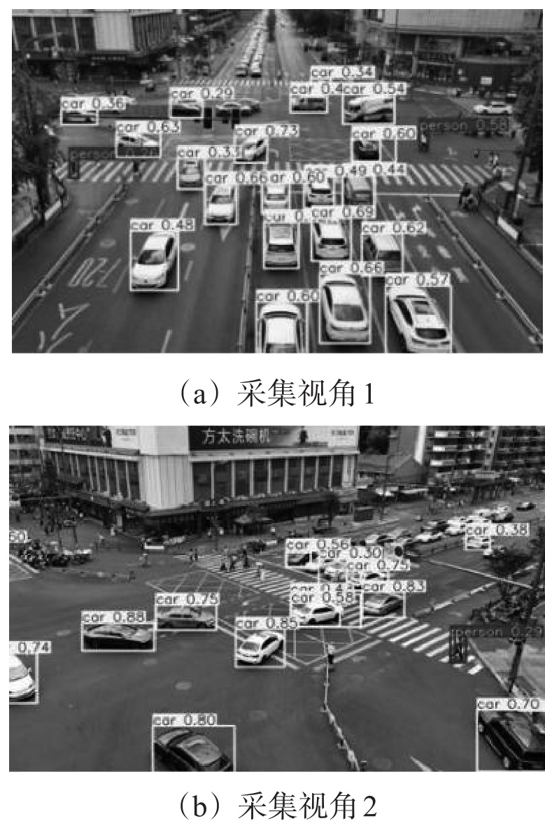
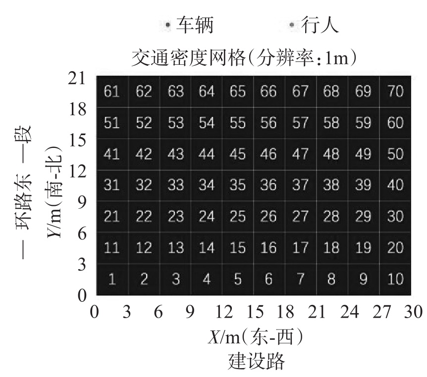
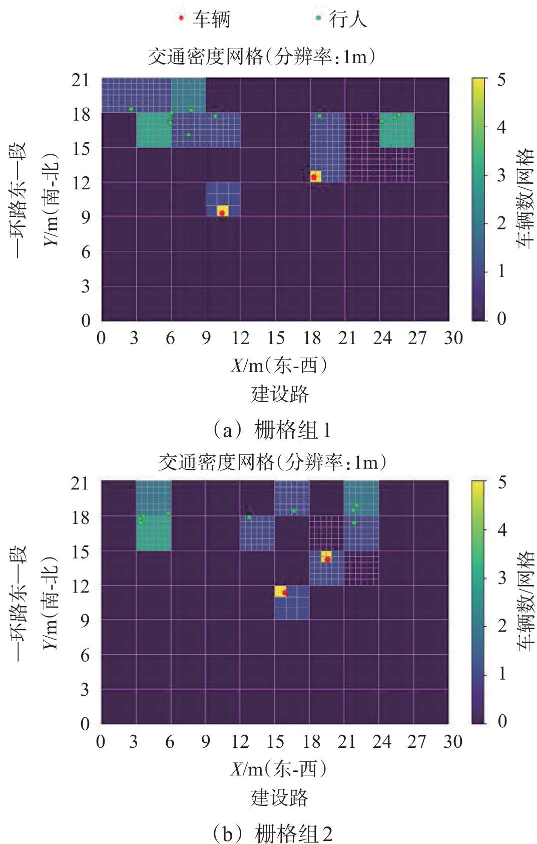
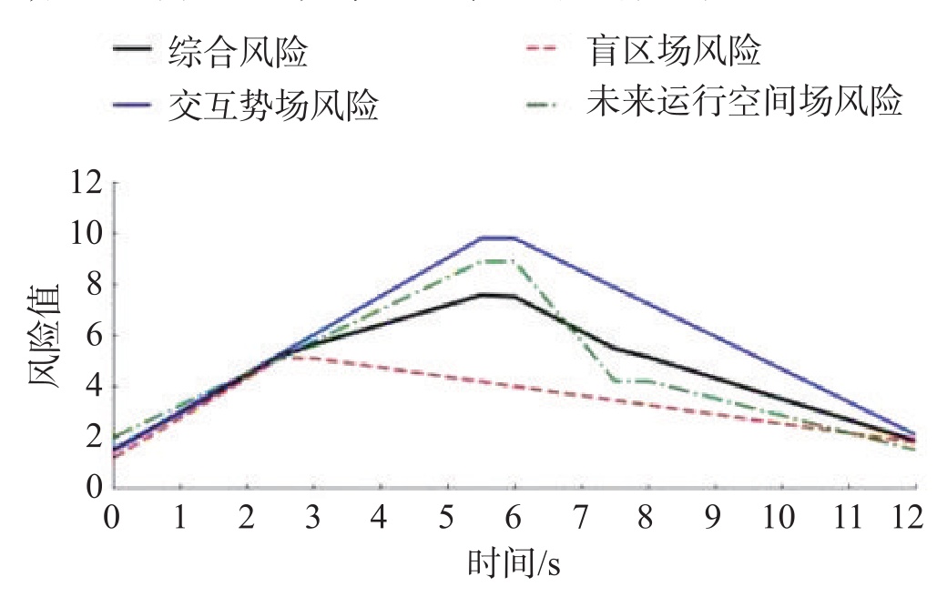
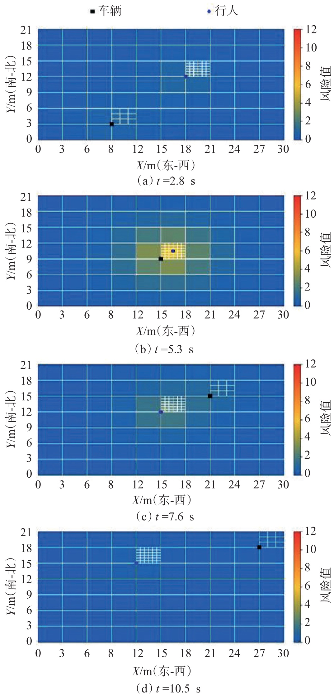
To address the complex pedestrian-vehicle interactions during left turns at intersections, an adaptive assessment framework based on a multi-dimensional fusion risk field is proposed. Limited observability, random motion states, and incomplete risk characterization are considered in the framework. The framework combines the YOLOv8n and DeepSORT to detect and track multiple road users from UAV aerial data. It extracts pedestrian crossing behaviors and vehicle motion features at intersections with high precision. Vehicle kinematic models and pedestrian stochastic motion models are established to describe pedestrian-vehicle motion states. A risk assessment model for left-turn scenarios is then constructed. The model integrates a blind spot field, an interaction potential field, and a field of possible future motion. An adaptive grid modeling method is further introduced to adjust spatial resolution according to risk complexity. This method improves computational efficiency while maintaining modeling accuracy in dynamic scenes. Simulation is conducted at the intersection of Jianshe Road and the East First Section of Yihuan Road in Chengdu. The model achieves a tracking accuracy of 97.30% and a localization accuracy of 0.71. Compared with existing tracking methods, it shows better stability and localization performance in dynamic pedestrian-vehicle interaction scenarios. Compared with fixed-grid methods, the adaptive grid method reduces computation time by 20.95% to 37.62%. The prediction error remains within ±2%. Compared with traditional risk assessment methods, the proposed multi-dimensional fusion risk field model performs best in conflict prediction accuracy and scenario adaptability. The proposed model enables high-precision, efficient, wide-area dynamic tracking and adaptive identification of pedestrian-vehicle interaction risks based on UAV aerial data.
A LSTM-BN Based Model for Real-time Vehicle Collision Risk Prediction
ZHAN Yixue, ZHANG Guilu, WEN Jianghui
2026, 44(1): 52-61. doi: 10.3963/j.jssn.1674-4861.2026.01.005
Abstract(76) HTML (26) PDF(10)
Abstract:
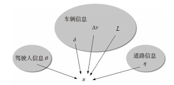
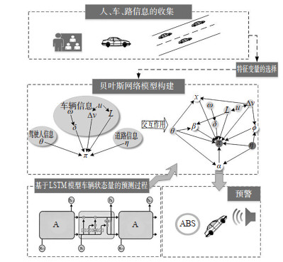
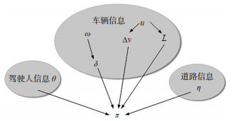
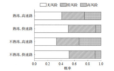
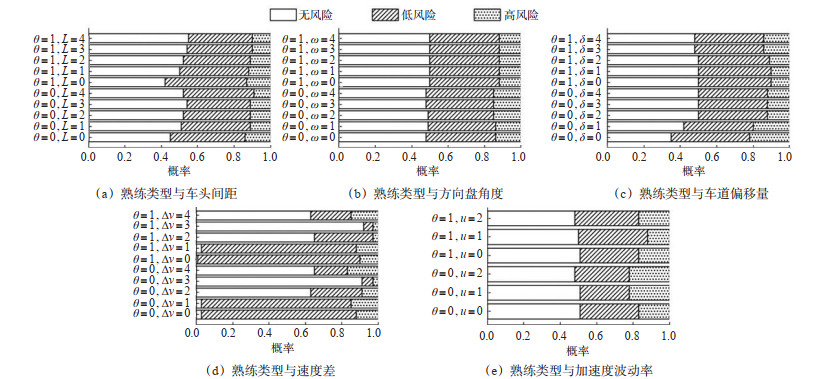
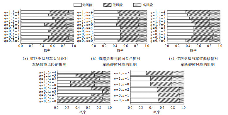
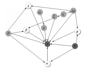
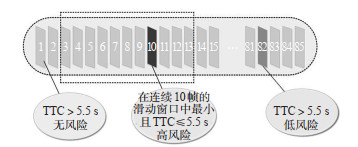
The development of vehicle-to-infrastructure cooperation (V2I) technology enables real-time dynamic information interaction between humans, vehicles, and roads, providing technical support for real-time vehicle collision risk prediction. Current models for predicting vehicle collision risk have limitations in capturing dynamic features and performing uncertainty inference. Thus, a two-layer progressive model based on long short-term memory-Bayesian network (LSTM-BN) is proposed. The LSTM-BN model utilizes LSTM at the bottom layer to capture the temporal evolution characteristics of vehicle states by setting a 0.1 s sampling window. At the top layer, the model performs probabilistic inference of collision risk through the BN. Based on data from naturalistic driving experiments in Wuhan, the time-to-collision (TTC) index is used to define and quantify the collision risk of vehicles (cars). This process yields 25, 826, 19, 344, and 4, 051 frames of no-risk, low-risk, and high-risk data, respectively. After preliminarily determining the variables affecting collision risk, the decision tree method is employed to extract key causal features from the dimensions of driver-vehicle-road. Interaction indicators, such as driver proficiency, speed difference, road type, and headway, are further excavated and characterized to reflect the non-linear coupling relationships among multi-dimensional factors. A Bayesian network reflecting these coupling relationship indicators is then constructed to evaluate the current vehicle collision risk. On this basis, to compensate for the deficiency of static probabilistic models in sequential prediction, LSTM is used to predict vehicle state variables. These variables are then mapped into the BN to infer the collision probability at the next time step. Through the above steps, the model achieves a precise prediction of real-time vehicle collision risk under dynamic evolution. To verify the effectiveness of the proposed model, its prediction performance is evaluated from four aspects: robustness, accuracy, timeliness, and complexity. Results from comparative modeling indicate that the LSTM-BN model achieves the highest accuracy at 91%. This performance is 7% and 12% higher than the accuracies of the support vector machine (SVM) and random forest (RF) models, respectively. Furthermore, its index fluctuations across different sampling periods are all below 0.1, demonstrating strong robustness.
An Evaluation Method of Visual-audiovisual Interventions Effectiveness for Sharp Bends on Mountainous Roads Based on Driving Simulation Tests
LIU Tong, XU Donghao, LIU Tangzhi, SUN Yezhe, LI Qixia
2026, 44(1): 62-74. doi: 10.3963/j.jssn.1674-4861.2026.01.006
Abstract(58) HTML (24) PDF(9)
Abstract:
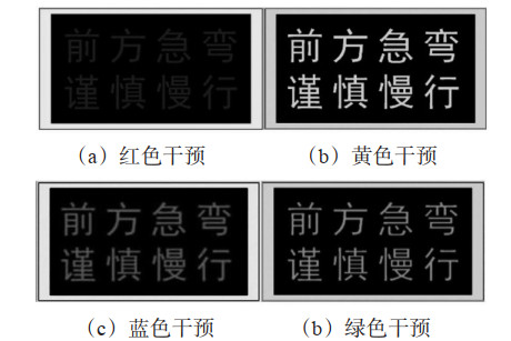
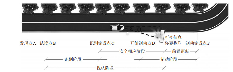
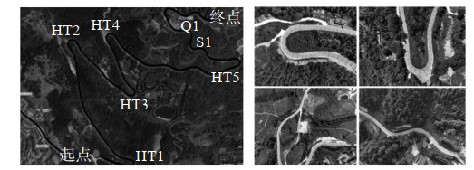
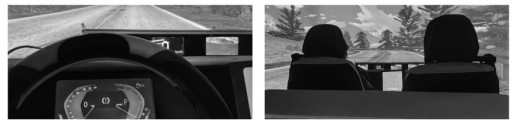
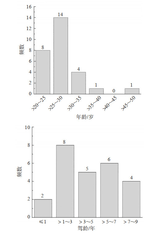
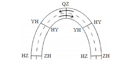
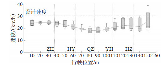
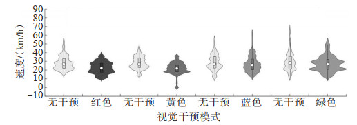
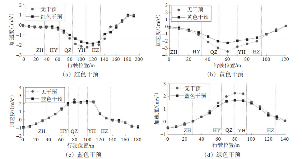
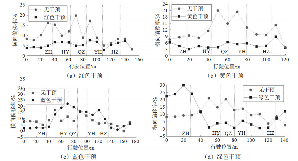
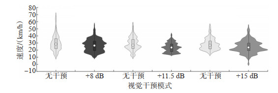
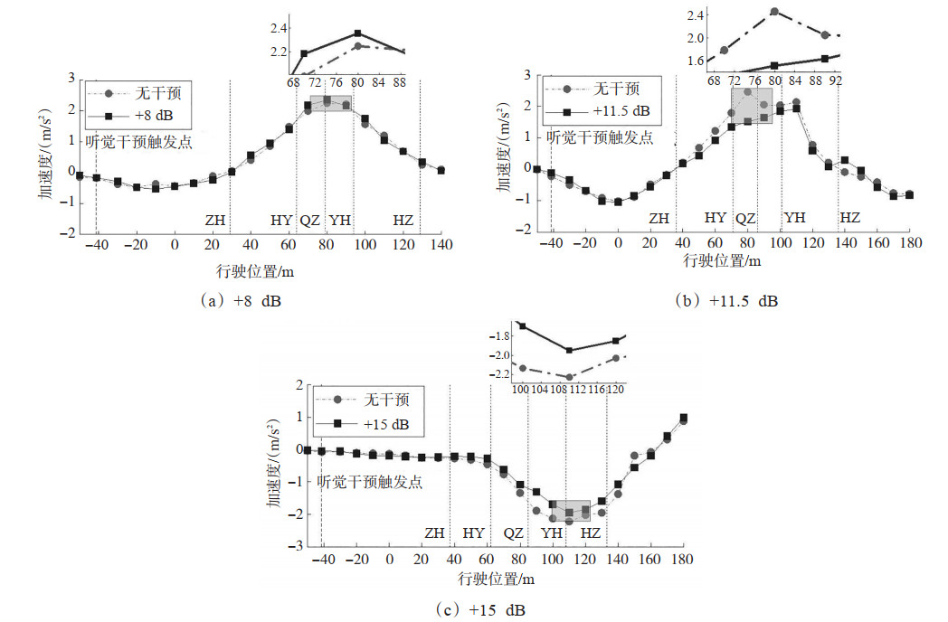
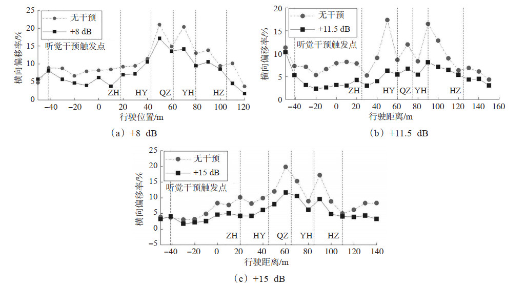
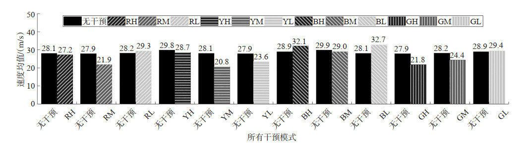
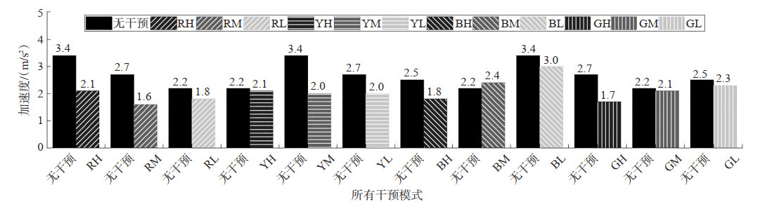
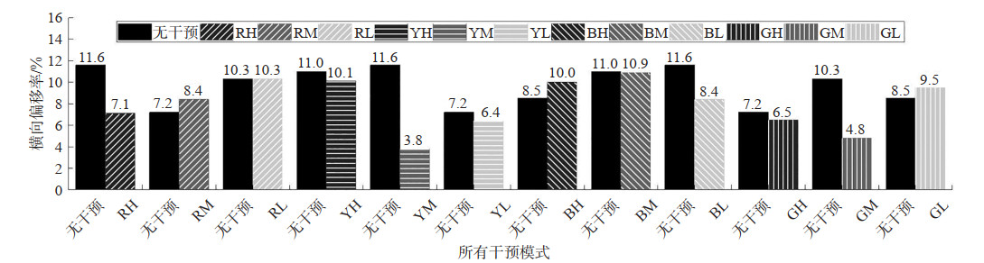
Existing research on the deployment of safety interventions primarily focuses on urban roads and highways. However, methods for evaluating the effectiveness of safety interventions at sharp bends on mountain roads remain limited. To clarify the effectiveness of different safety interventions and the basis for placement, a driving simulation scenario is established based on the S545 section in Yongchuan, Chongqing. Twenty-eight drivers are recruited to participate in the driving simulation tests. Variable message signs (VMS) in four colors: red, yellow, blue, and green—are selected as visual interventions. On the basis of the steady-state noise from the driving simulator, on-board warning sounds with increases of 8, 11.5, and 15 dB are added as auditory interventions. Single-modality and audiovisual combination experiments are designed, and a model for calculating the distance for placing interventions is proposed. The effectiveness of different interventions is comprehensively evaluated by analyzing the average speed, peak acceleration, and lateral deviation rate. The results indicate that, at sharp bends on mountain roads, the distances for placing visual and auditory interventions are 31.4 m and 41.7 m, respectively. The yellow VMS is the optimal single visual intervention, with reductions in average speed, peak acceleration, and lateral deviation rate of 22.3%, 34.7%, and 58.4%, respectively. The 11.5 dB increase condition is the optimal single auditory intervention, with reductions in average speed, peak acceleration, and lateral deviation rate of 17.3%, 38.5%, and 43.7%, respectively. Both the yellow VMS single visual intervention and the 11.5 dB auditory intervention yield good results. The yellow VMS and 11.5 dB combination intervention achieves the best effect, with reductions in average speed, peak acceleration, and lateral deviation rate of 26.0%, 40.3%, and 66.9%, respectively. This combination intervention is superior to single interventions and is recommended as the preferred deployment scheme for sharp bends on mountain roads.
Map-conditioned Generative Adversarial Networks for Automotive Trajectory Privacy Protection
XIN Chongshi, WANG Liyong, JI Haojie, JIN Long, HU Te
2026, 44(1): 75-87. doi: 10.3963/j.jssn.1674-4861.2026.01.007
Abstract(60) HTML (18) PDF(5)
Abstract:
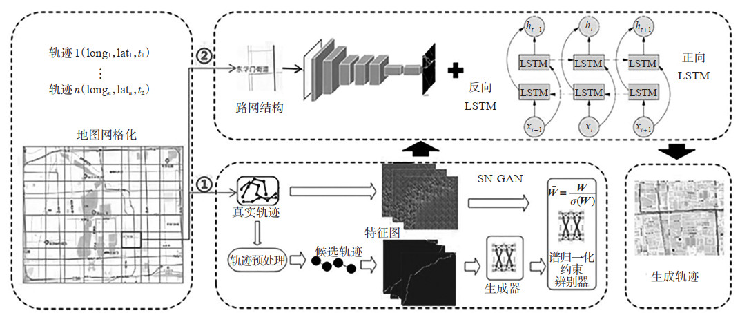
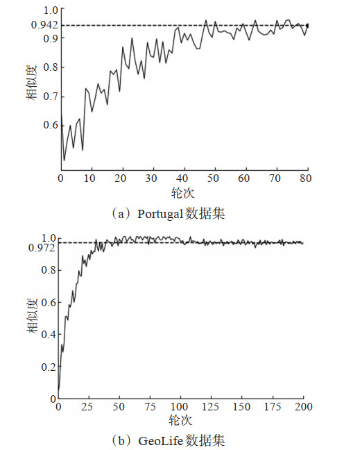
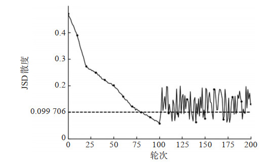
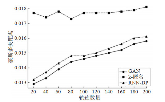
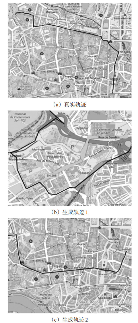
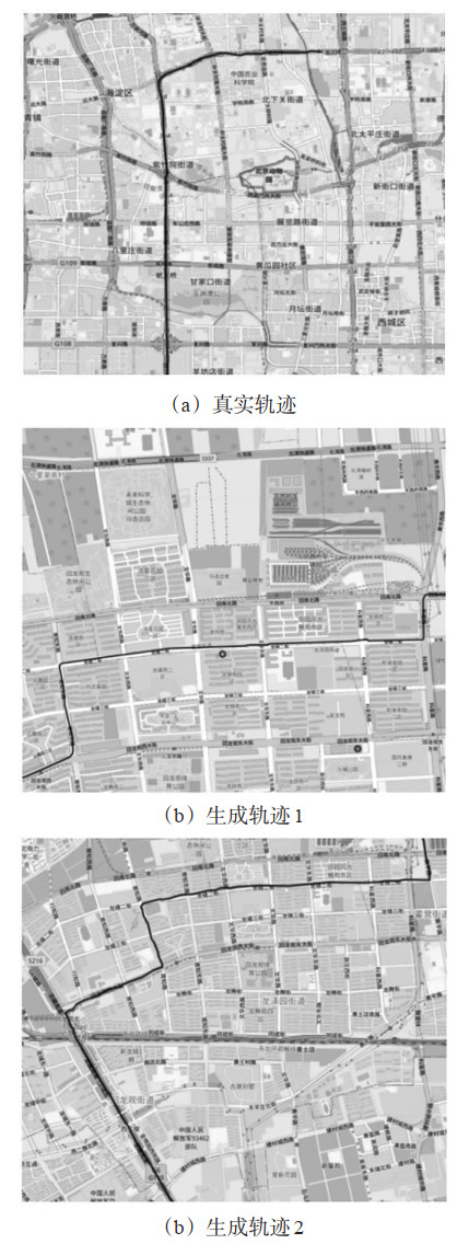
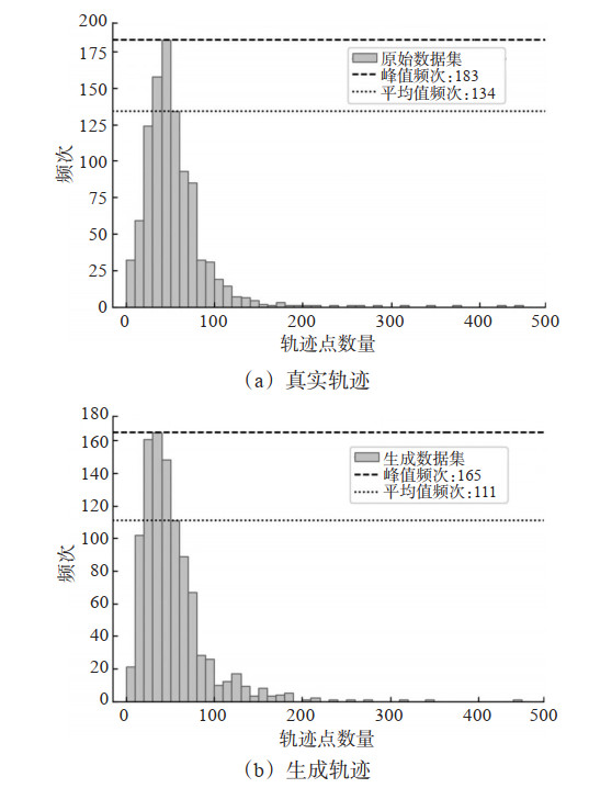
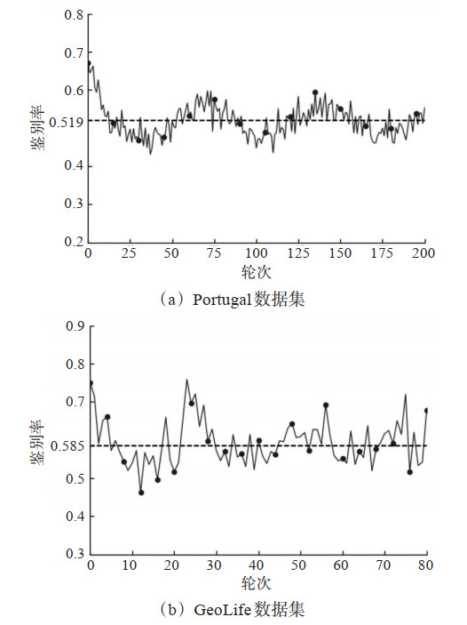
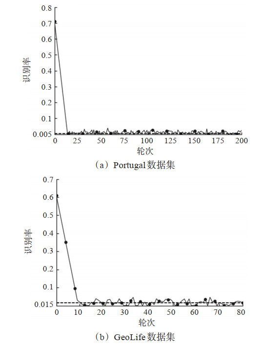
Privacy protection methods based on pseudo-trajectory generation face vanishing gradients in large-scale sequence modeling and trajectory distortion due to insufficient modeling of geographic semantics. To address these problems, this paper proposes a map-conditioned trajectory generation framework (MCTG) based on generative adversarial networks. SN-GAN is employed to learn the global spatial distribution of trajectories. Constraints on the spectral norm of the discriminator stabilize training over long sequences and suppress mode collapse. A conditional GAN incorporating geographic semantics is further constructed, with an encoder-decoder architecture for extracting features of road networks. A symmetric bidirectional long short-term memory (LSTM) combined with a teacher-forcing mechanism jointly models temporal dependencies and boundary constraints of trajectory sequences. Experiments on the geolife and portugal datasets show that the cosine similarity between synthetic and real trajectories reaches up to 0.98, remaining stable within 0.90~0.95 under complex multi-modal conditions. The Jensen-Shannon divergence decreases from 0.22 to 0.105, indicating good distributional consistency. The Hausdorff distance of the synthetic trajectories is consistently lower than those of k-anonymity and differential privacy, reflecting superior preservation of spatial morphology. In simulated privacy attacks, the recognition rate for synthetic trajectories falls below 0.01 and the discriminator accuracy approaches 0.519, indicating that real and synthetic trajectories are nearly indistinguishable. MCTG enables effective privacy protection for vehicle trajectory data by generating synthetic trajectories with high geographic plausibility while preserving statistical distribution consistency and road-network semantic constraints.
Ship-Shore Collaborative Remote Control System Architecture for Inland Autonomous Ships
XIA Tong, HUANG Yanmin, WEN Yuanqiao, HAN Haihang, HU Taiwei
2026, 44(1): 88-100. doi: 10.3963/j.jssn.1674-4861.2026.01.008
Abstract(64) HTML (22) PDF(4)
Abstract:
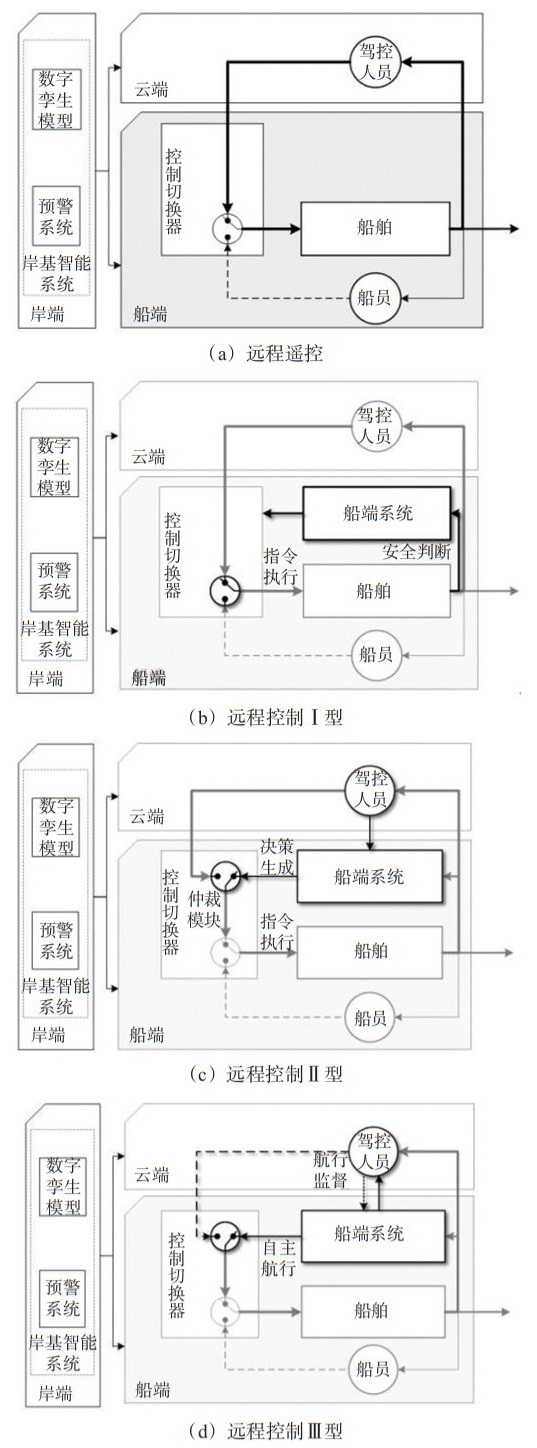
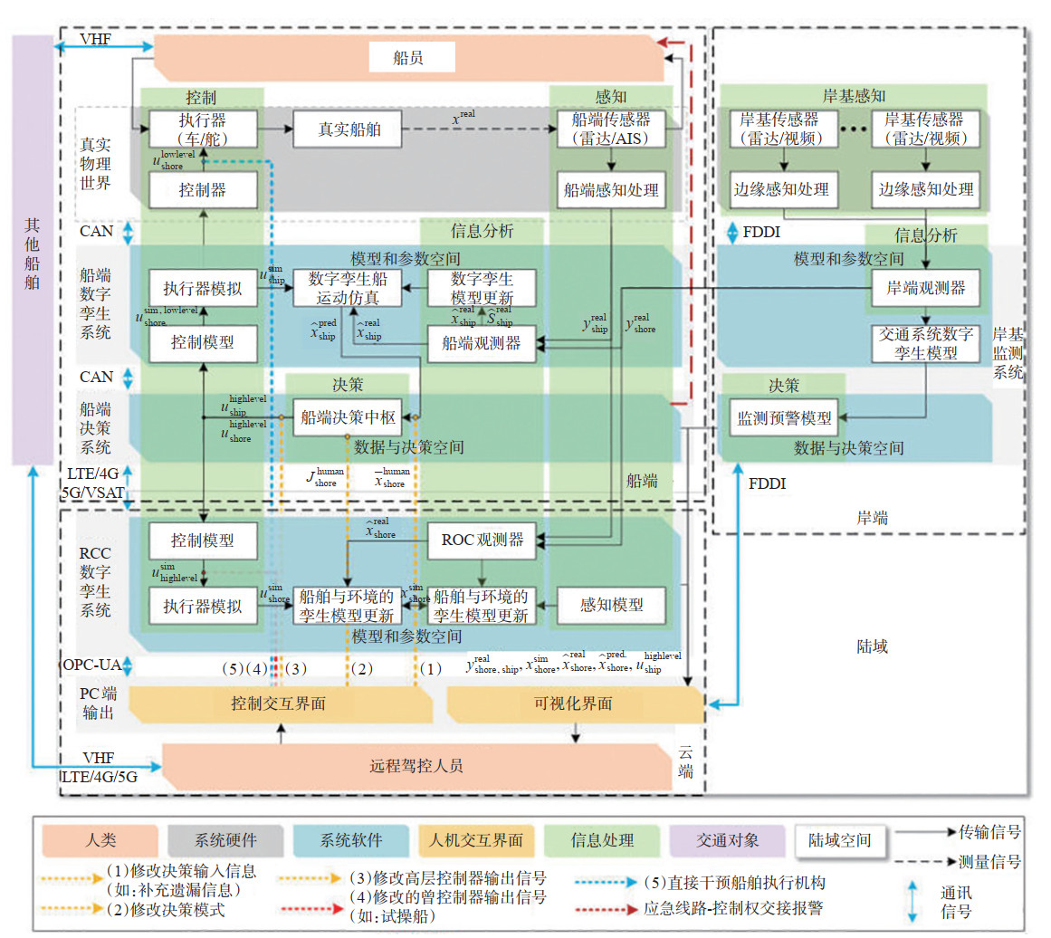
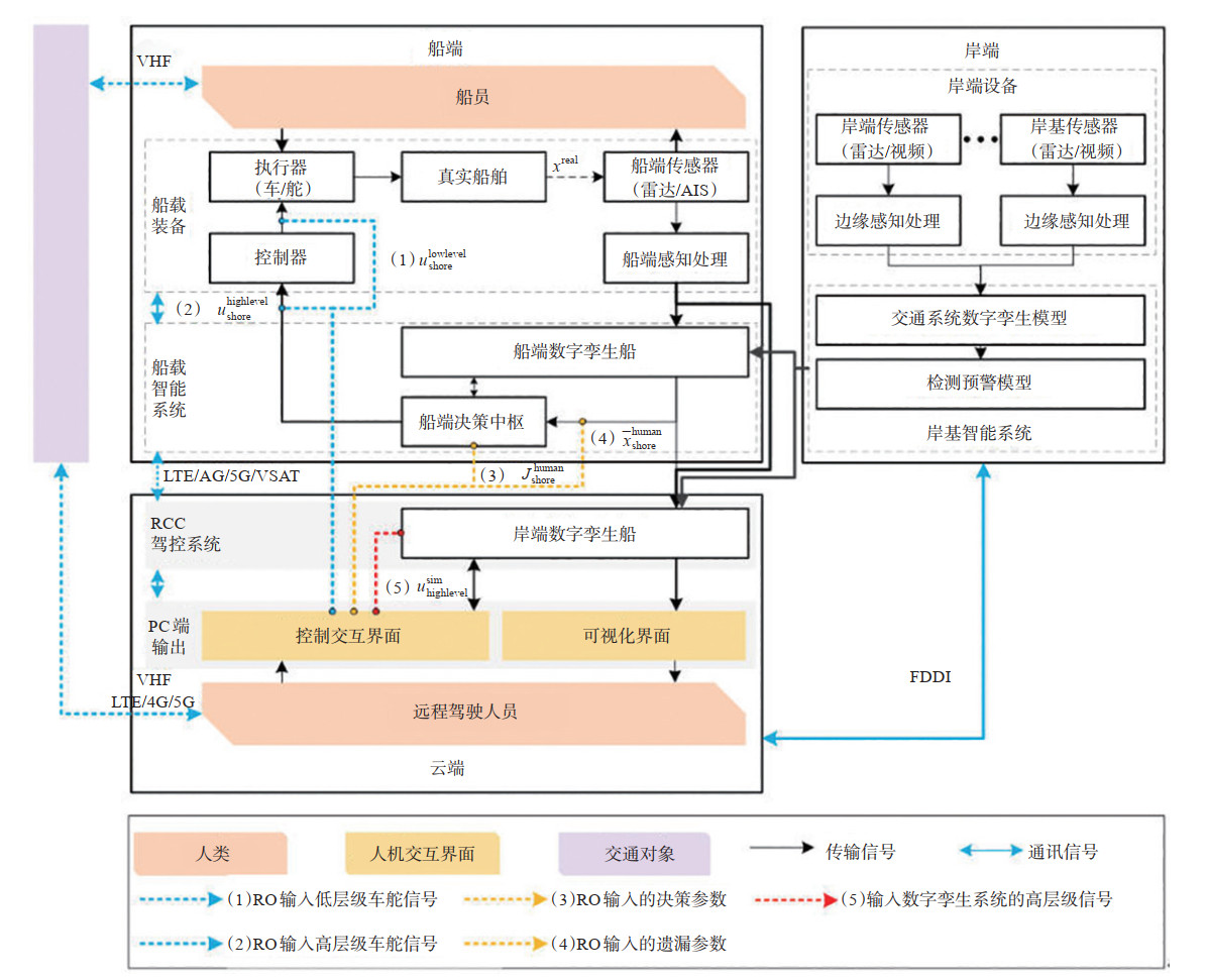
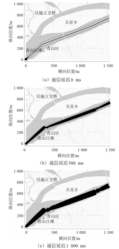
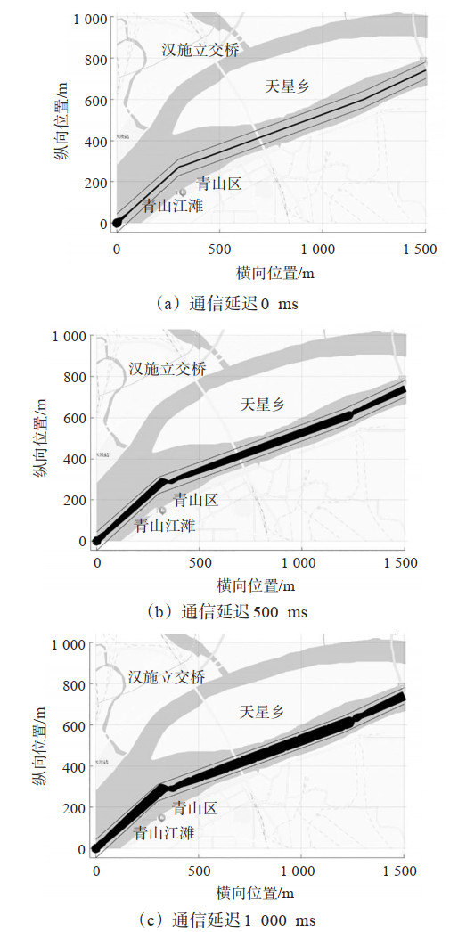
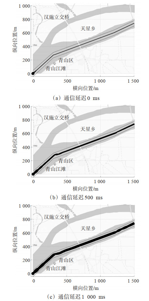
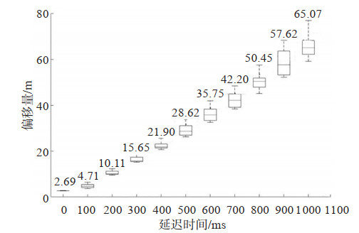
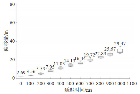
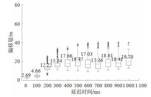
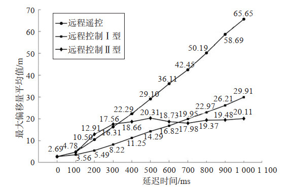
The traditional ship control system architecture can hardly meet the practical demands for Ship-Shore Coordination upgrading and Remote Control function deployment, and the lack of a unified framework directly restricts the efficiency of ship-shore collaborative operations. To ensure the adaptability and consistency of the ship remote control system in this scenario, this paper proposes Modes of Remote Navigation and a Remote Control Architecture suitable for inland waterway Autonomous Ships. Based on literature review and comparative analysis of relevant specifications, four basic remote navigation modes are proposed: remote teleoperation (directly executing rudder and propulsion commands), Remote Control Mode Ⅰ (remote command safety judgment), Remote Control Mode Ⅱ (autonomous navigation decision-making and Human-Machine Interaction command fusion), and Supervisory Remote Control Mode Ⅲ (fully autonomous navigation supervision). A'Ship-Shore-Cloud'collaborative architecture for inland waterway scenarios is constructed, clarifying system functional division and information flow. Six remote navigation information services and five human-machine interaction modes are designed, with the implementation path of integrating shore-based/cloud data links into the ship control system defined. Finally, simulation experiments compare control performance under different ship-shore communication delays. Results show that Remote Control Mode Ⅱ enhances robustness in high-delay environments, Mode Ⅰ performs optimally in medium-delay conditions, and remote teleoperation achieves satisfactory effects in low-delay scenarios. The proposed modes and architecture provide core technical support for the engineering application of inland autonomous ship remote navigation, while the interaction design and delay adaptation suggestions offer important references for optimizing ship-shore coordination efficiency.
A Spatio-temporal Transformer-STGNN Hybrid Reinforcement Learning Method for Bus Cooperative Optimization
ZHANG Yunbo, ZHOU Xuemei, WANG Peiyu, XU Ao, DAI Yongqi
2026, 44(1): 101-112. doi: 10.3963/j.jssn.1674-4861.2026.01.009
Abstract(46) HTML (25) PDF(1)
Abstract:
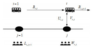
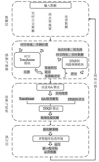
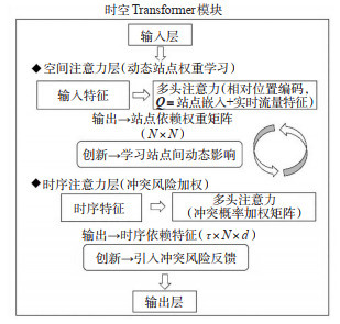
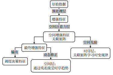
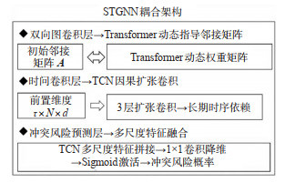
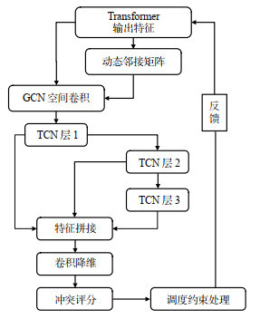
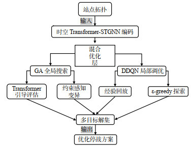
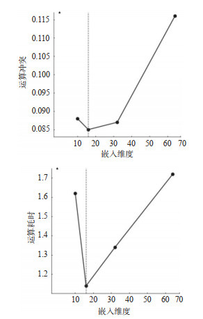
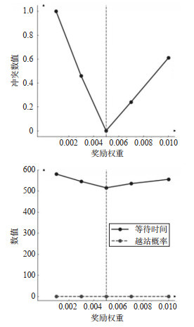
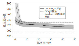
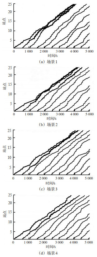
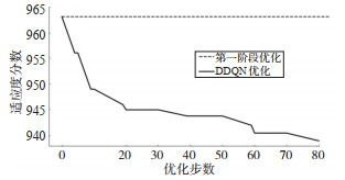
To address multi-objective conflicts and global ripple delays caused by local decisions, a dynamic cooperative optimization model is investigated. This model integrates a Spatio-Temporal Transformer and a spatiotemporal graph neural network (STGNN). A bidirectional interactive architecture for the perception and anticipation of spatiotemporal features is constructed. Dynamic dependencies of bus stops are extracted using the spatial attention mechanism of the Transformer. An adaptive weight matrix is generated and subsequently inputted into the STGNN as a dynamic adjacency matrix. This network combines graph convolutional networks and causal dilated convolutions to predict risks of passenger accumulation and delay propagation. The anticipated risk scores are reversely transmitted to the temporal attention layer. Driven by risks, this closed-loop feedback mechanism adjusts the weights. Thereby, the nonlinear ripple effects in space and time generated by single scheduling decisions are quantified. A hybrid reinforcement learning framework is designed. An improved genetic algorithm (GA) and a Deep Double Q-Network (DDQN) are nested in this framework. A Pareto front solution set is generated using the global broad search of the GA. This set serves as the initial strategy space for the DDQN. Simultaneously, the risk scores from the STGNN are introduced into the multi-objective reward function as safety constraint penalties. Consequently, the operational efficiency of vehicles and the travel costs of passengers are balanced. Thus, optimal coordinated control strategies for stop-skipping and holding are generated. Simulation experiments are conducted based on the operational data of Foshan Bus Route 101 during peak hours. The results indicate that the fluctuations in headways are controlled by this strategy. Furthermore, the continuous bus bunching phenomenon is successfully avoided. Under the premise of a 0.83% increase in the average passenger waiting time, the average passenger in-vehicle time is reduced by approximately 24.7%. Meanwhile, the overall vehicle travel time is shortened, and the driving speed between stops is improved. Compared with traditional single deep reinforcement learning algorithms, this hybrid algorithm exhibits fewer iteration counts and smaller optimization errors. The proposed model is applicable to the real-time cooperative scheduling for urban trunk buses with high-frequency departures. A dynamic balance of multiple scheduling strategies is achieved under the premise of controlling risk propagation.
Navigation Status Control of Cargo Ships in the Three Gorges Dam-Gezhouba Dam Cascade Navigation Hubs
ZHAO Zunrong, HAN Ya, WU Bing, XU Xueqian
2026, 44(1): 113-126. doi: 10.3963/j.jssn.1674-4861.2026.01.010
Abstract(49) HTML (15) PDF(2)
Abstract:
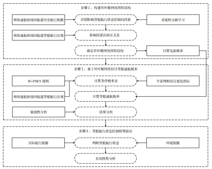
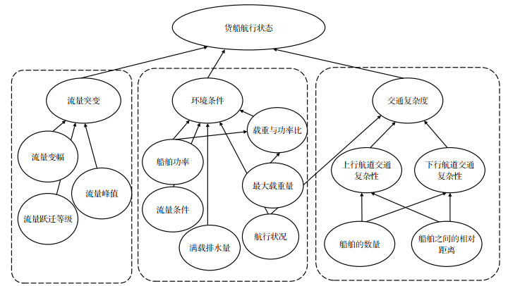
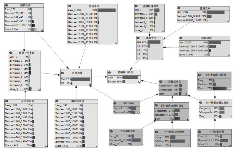
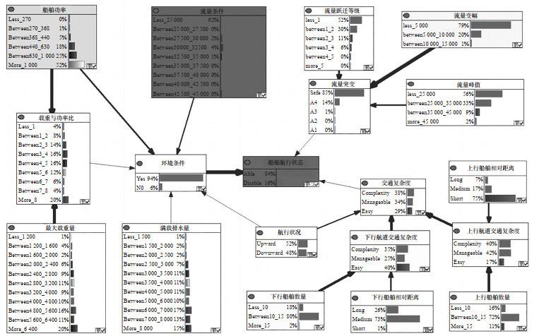
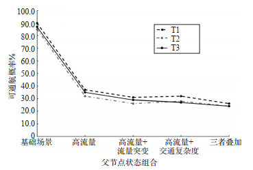
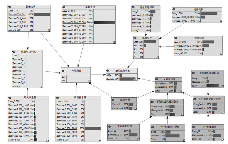
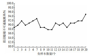
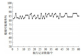
This study addresses the high navigation risk of cargo ships caused by the drastic flood-season flow changes between the Three Gorges and Gezhouba navigation hubs. A navigation state control model for cargo ships based on a Bayesian network is developed to identify ships that fail to meet navigation conditions and to evaluate their permissible navigation probability. The model structure is designed according to the waterway's navigation characteristics and includes three modules: environmental conditions, flow mutation, and traffic complexity. An influencing factor system couples ship attributes with channel flow variations. The flow mutation module evaluates mutation grades using flow peak, variation amplitude, and transition grade to represent flood-season flow changes.The traffic complexity module considers separate upstream and downstream navigation, using a five-hour analysis window, and graded indexes of ship quantity and spacing to characterize channel traffic state. Node conditional probability tables are determined using the Flood Season Navigation Flow Standard, survey results, and IF-THEN rules to address difficulty in directly obtaining model parameters. The Bayesian network calculates permissible navigation probabilities, forming a navigation state control framework for navigation access. Verification with five actual ship samples, multiple noncompliant samples, and sixty dam-passing records shows that all five actual ship samples have permissible navigation probabilities above 80%, consistent with observed operations. Noncompliant samples have non-navigation probabilities of 88%~95%, identifying high-risk conditions. Sixty dam-passing records show permissible navigation probabilities of 82%~88%, averaging 85%, consistent with operational records. Sensitivity analysis identifies flow conditions and ship power as the main factors influencing cargo ship navigation state control.
An Improved YOLOv8s Algorithm for Lane Detection in Road Scenes
QIAN Jinming, WANG Qing, LIU Pengfei
2026, 44(1): 127-138. doi: 10.3963/j.jssn.1674-4861.2026.01.011
Abstract(53) HTML (27) PDF(5)
Abstract:
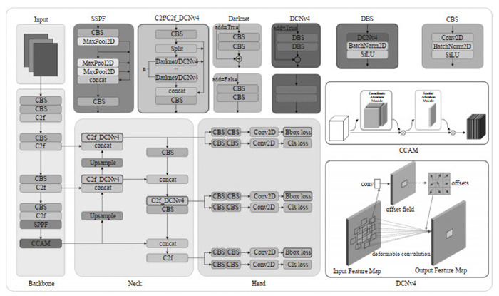
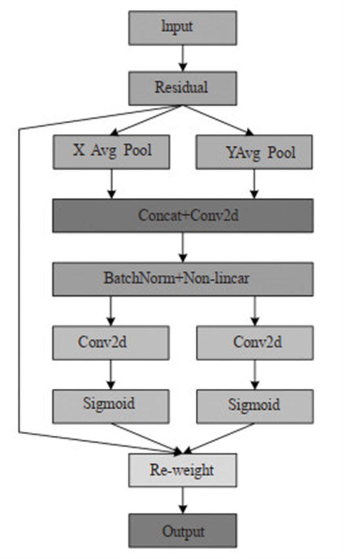
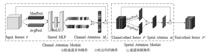
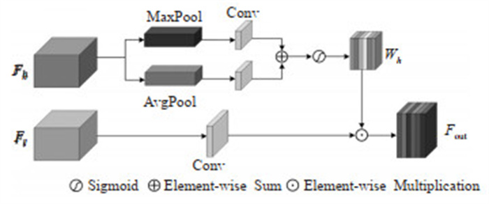
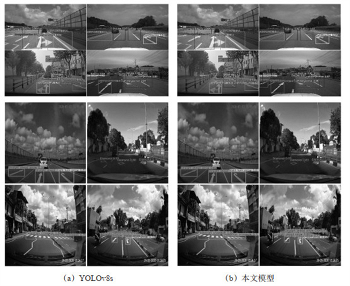
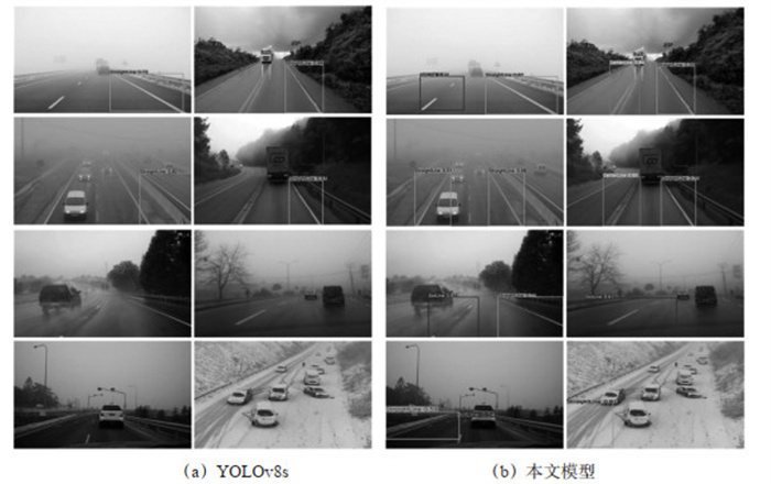
Accurate lane detection from road scene images is crucial for environment perception in autonomous driving and intelligent transportation systems. However, in complex traffic scenarios, lane markings are slender, variable in shape, and easily affected by illumination changes, occlusion, and adverse weather, which restricts the feature representation and structural modeling capability of the conventional YOLOv8s lane detection model, resulting in suboptimal detection accuracy and robustness. To overcome these limitations, this study proposes an improved YOLOv8s-based lane detection algorithm, YOLOv8s-CLW. A composite attention mechanism is integrated into the feature extraction stage to enhance the network's focus on critical semantic features and spatial information of slender lane markings. Lightweight deformable convolution is introduced to adaptively model curved and non-rigid lane structures, and an improved bounding box regression loss is employed to enhance localization stability and detection precision. Experimental results demonstrate that, on the original test set, YOLOv8s-CLW achieves a Recall of 50.0% and a mAP of 59.8%, representing improvements of 0.6% and 8.9% over the baseline YOLOv8s. On an external validation set, Precision, Recall, and mAP reach 93.0%, 92.0%, and 96.1%, demonstrating significant performance gains. Qualitative visualization results under complex weather conditions (fog, rain, dust, and snow) indicate that the model can still detect partial lane lines, with the number of detected lane lines ranging from approximately 30% to 85% of that under normal conditions—80%~85% under mild interference and 30%~50% under extreme weather, while maintaining continuity and completeness of predictions, reflecting strong environmental adaptability and robustness.
An Analysis of the Impact Characteristics of Manned and Unmanned Aircraft Integrated Operation on Air Traffic Control Performance
ZHANG Xingjian, ZHENG Wenhui, MENG Linghang, ZHAO Yifei, LIU Mingyuan
2026, 44(1): 139-148. doi: 10.3963/j.jssn.1674-4861.2026.01.012
Abstract(43) HTML (17) PDF(1)
Abstract:
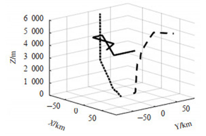
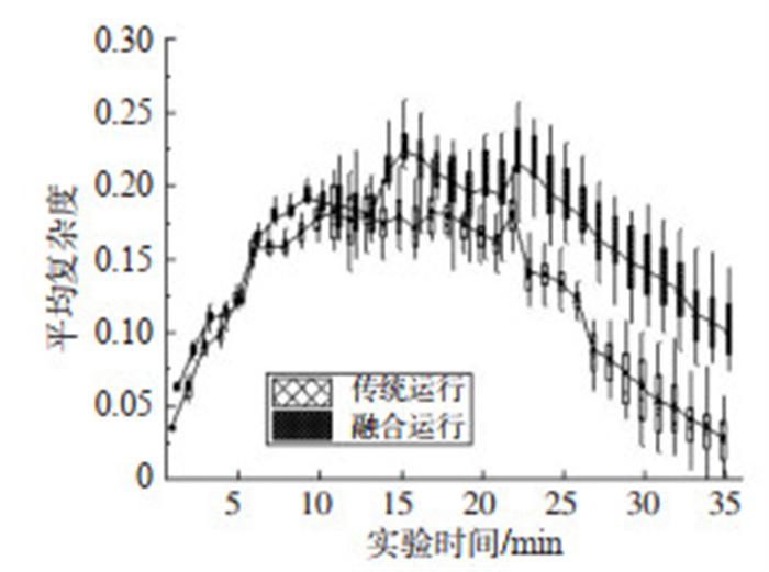
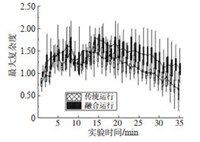
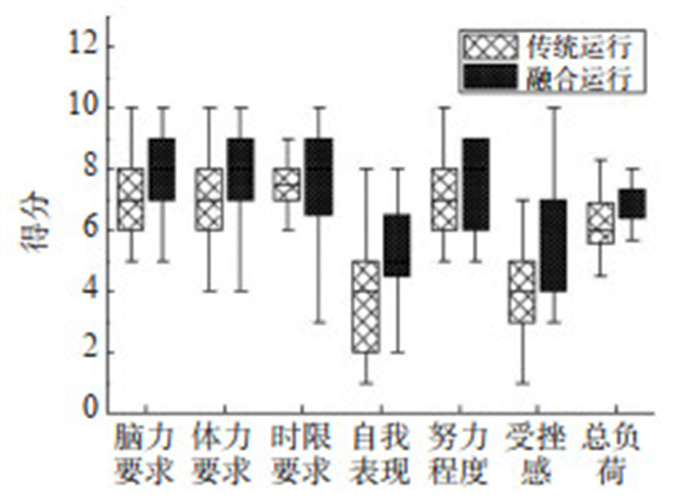
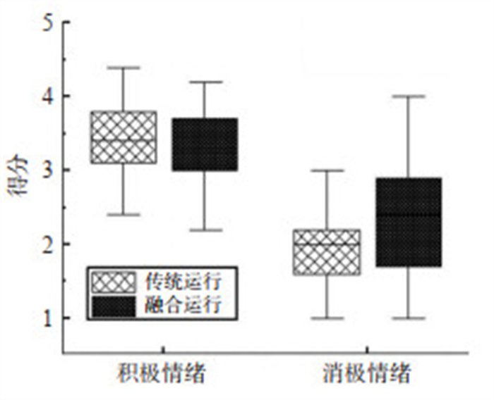
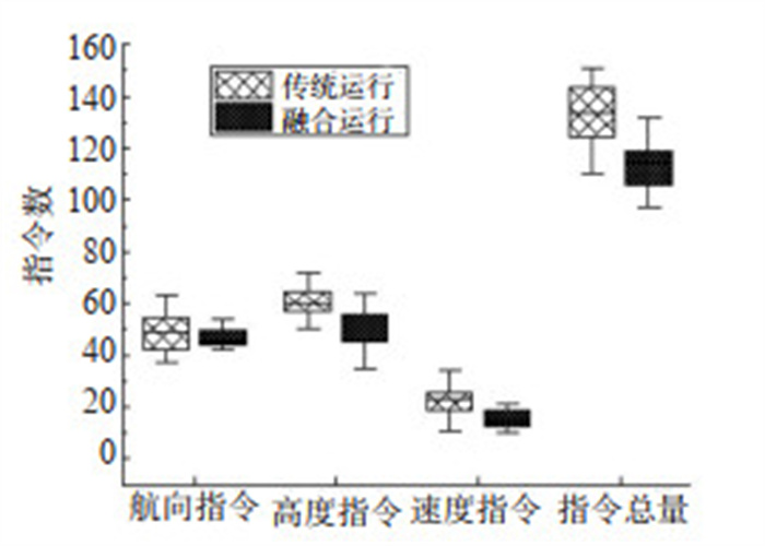
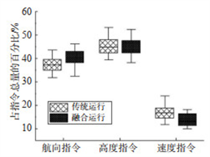
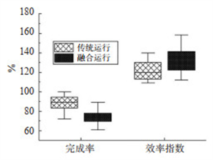
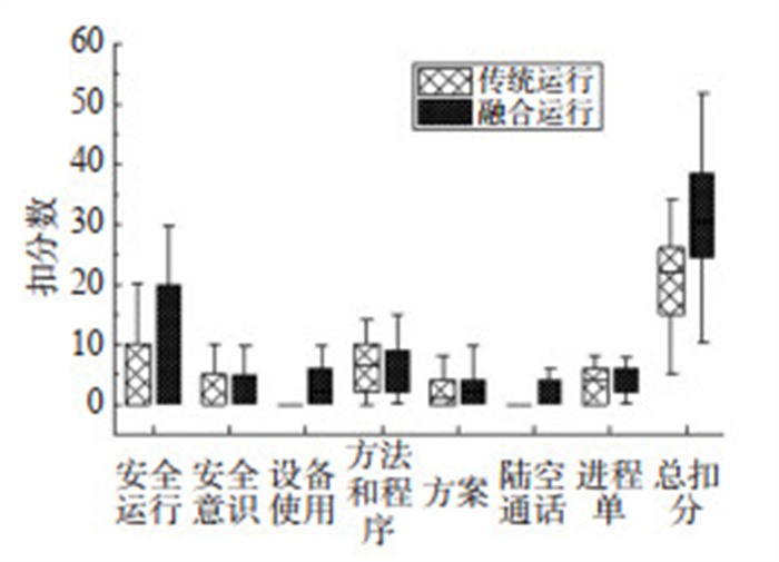
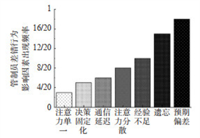
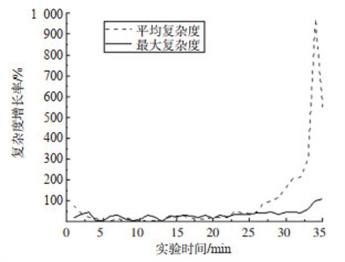
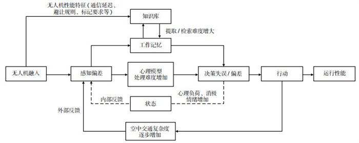
With the rapid development of large unmanned aerial vehicles (UAVs), their integration into controlled airspace alongside manned aircraft has become a significant trend. This integration requires UAVs to actively adapt to existing air traffic control (ATC) paradigms. However, the potential impact of such integrated operations on air traffic controllers'(ATCOs) performance remains unclear, which consequently constrains the design of effective integration strategies. In order to investigate the impact mechanism of integrated operations on ATCOs'performance, this study designed two scenarios-traditional operations and integrated operations-within a terminal control area. A simulation experiment is conducted with 20 recruited ATCOs. The performance is evaluated using seven metrics across four dimensions: traffic situation characteristics, controller psychology, operational behavior, and outcomes. These indicators included air traffic complexity, mental workload, emotional state, the number of instructions, completion rate, efficiency, and control score. The differences in these indicators are analyzed using paired sample t-tests. The results indicated a significant decline in multiple performance indicators under the integrated operations scenario. Compared to traditional operations, the average and maximum air traffic complexity increased by 93.81% and 32.93%, respectively. Mental workload and negative emotions increased by 13.78% and 20.83%, respectively. The number of heading, altitude, and speed instructions decreased by 6.72%, 16.26%, and 30.79%, respectively. Furthermore, the completion rate, efficiency, and control score decreased by 14.47%, 8.03%, and 64.61%, respectively. From the perspective of cognitive information processing, these impacts exhibit a comprehensive, cyclical, and interactive character. In summary, the impact of integrated operations is primarily manifested in three aspects: ①the interaction between aircraft becomes more complex and exhibits a cumulative effect, increasing the difficulty of ATC command.②ATCOs experience increased cognitive and mental workload, alongside elevated negative emotions, which can easily lead to issues such as imbalanced attention allocation and decision-making delays. ③UAV-specific characteristics, such as communication latency and conflict resolution protocols, can disrupt the rhythm of ATC operations, thereby leading to a degradation in overall control performance.

Deep Reinforcement Learning-based Dynamic Capacity Planning for Consecutive Highway Charging Stations
SONG Li, NIE Ke, GUO Kai, LEI Li, TAO Xinrui, LUO Kaizhen
2026, 44(1): 149-158. doi: 10.3963/j.jssn.1674-4861.2026.01.013
Abstract(44) HTML (16) PDF(2)
Abstract:
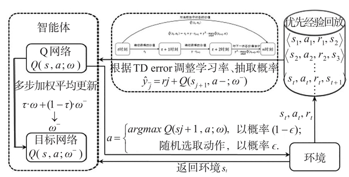
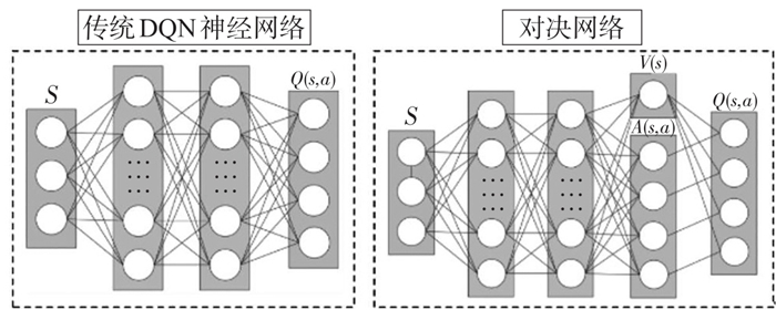
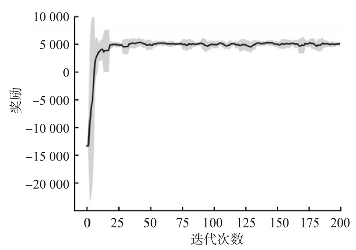
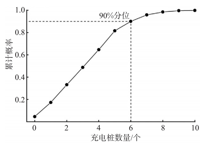
The contradiction between the surging number of new energy vehicles and the inadequate charging services on highways becomes increasingly prominent. Compounding this issue, traditional multi-objective planning methods for charging stations rely on static assumptions and fail to adapt to dynamic traffic environments. To resolve these limitations, a dynamic capacity planning model based on deep reinforcement learning is proposed for consecutive highways charging stations. The capacity planning problem for consecutive charging stations is modeled as a Markov decision process. The state space integrates real-time operational metrics of charging stations and dynamic vehicular features to characterize the nonlinear coupling among traffic flow, charging demand, and user behavior. Furthermore, a multi-objective reward function balances user satisfaction and operational costs is designed. Algorithmically, the D3QN-PER-2s algorithm is developed. It combines the Dueling deep Q-network (DQN) architecture to separate state value from action advantage functions and employs Double DQN to mitigate Q-value overestimation problem. Additionally, a prioritized experience replay mechanism is introduced to evaluate experience importance and conduct priority sampling. To enhance learning stability, the algorithm further adopts a two-step temporal difference update strategy that incorporates future rewards and value estimates. The model interacts with the SUMO simulation environment for real-time learning, eliminating the dependence on historical data. To generate highly robust planning solutions, a quantile analysis strategy based on the empirical cumulative distribution function is introduced. Statistical analysis is conducted on extensive simulated decisions after training. The 90th percentile value is selected as the final plan, effectively balancing cost-effectiveness and robustness against demand fluctuations. Experimental results demonstrate that the proposed deep reinforcement learning-based scheme controls the proportion of queuing vehicles to within 10% reduces the average queuing time to less than 3 minutes. Compared to a multi-objective queuing model solved by genetic algorithm, this approach reduces construction costs by 24.3% and improves peak-hour charger utilization by 17.4%. These results prove the superiority of the proposed method in solving multi-objective capacity planning problem of chargers, enhancing the efficiency of highway charging services and user charging experience.
An Optimization Method for Metro Passenger Flow Control by Tracing Congestion Sources
WANG Yao, CAO Ningmu, CHEN Shaokuan, SHI Mengtong, XIAO Di
2026, 44(1): 159-169. doi: 10.3963/j.jssn.1674-4861.2026.01.014
Abstract(42) HTML (21) PDF(1)
Abstract:
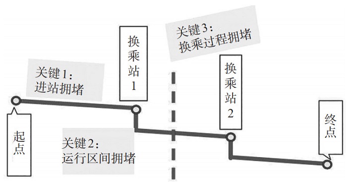
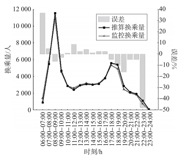
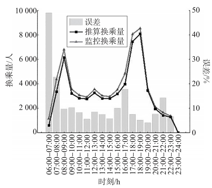
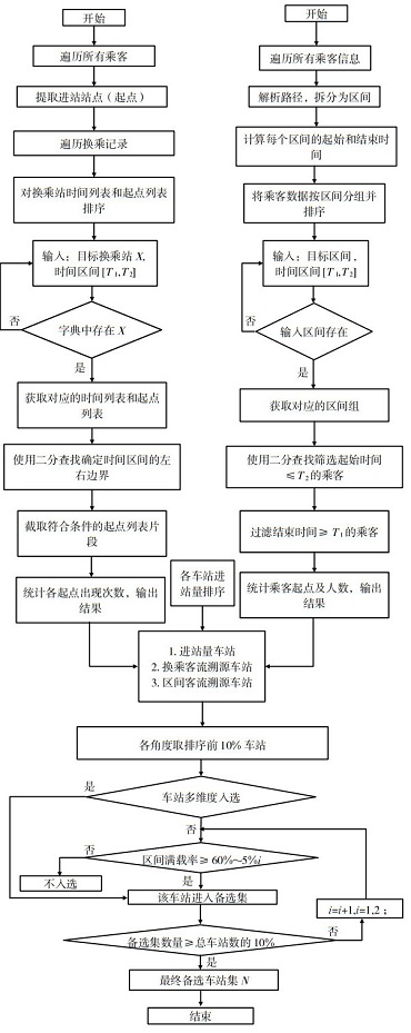
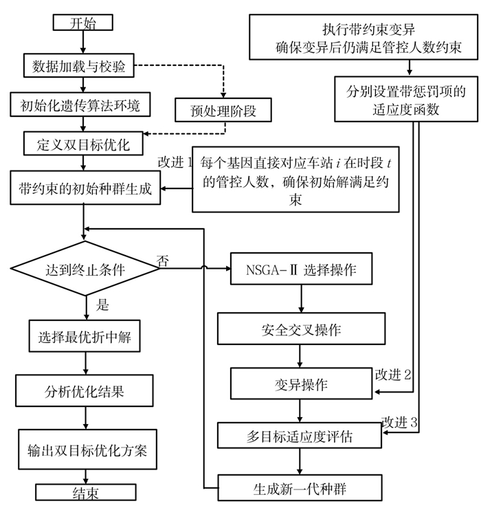
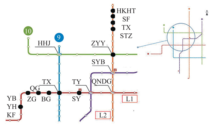
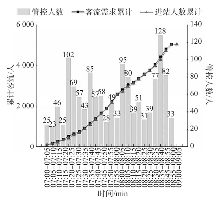
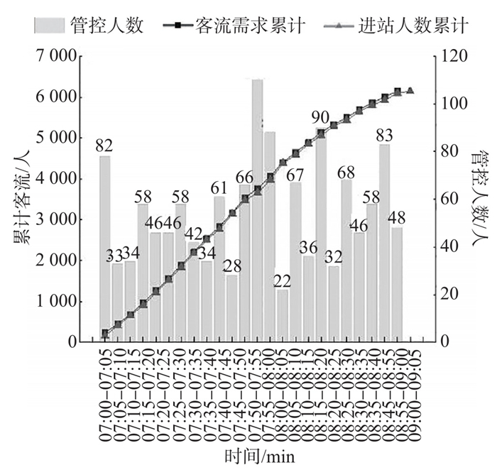
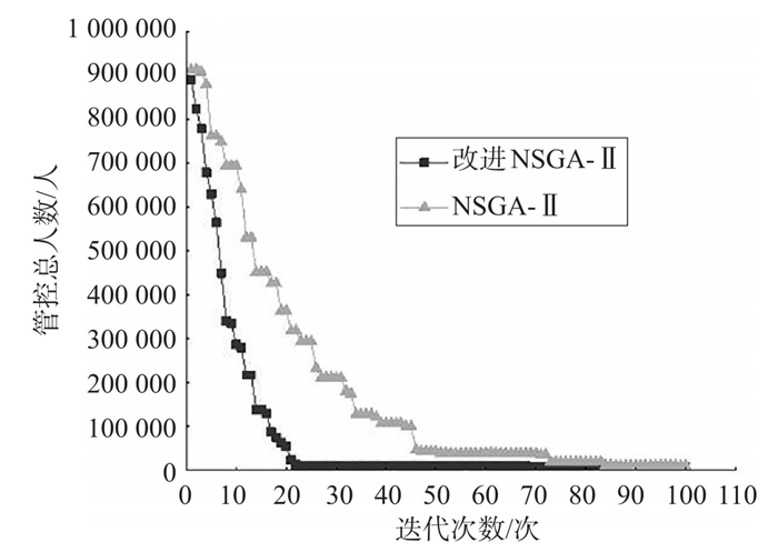
Single-station control measures cannot alleviate network-level congestion from the source. This study investigates a multi-station collaborative control method to address peak-hour congestion and safety hazards through tracing passenger flow sources in metro networks. This method identifies source stations of congestion through three dimensions. First, the stations with persistently high inbound volumes are selected to reduce the pressure entering the network. Second, the stations with significant transfer congestion are located, and their main source stations are determined via tracing passenger flow. Third, the bottleneck sections are traced to identify the initial source stations. A multi-dimensional source tracing model is constructed to determine which stations are require to control. Based on this logic, an optimization model is developed. This model minimizes three objectives: the number of stranded passengers, the average load factor, and the maximum platform occupancy. It links source control with transfer relief through dynamic adjustment of inbound volumes. The constraint conditions include interval capacity, platform capacity, and load factor. An improved non-dominated sorting genetic algorithm (NSGA-Ⅱ) is designed to solve the model. The algorithm incorporates constraint-aware genetic operators, a fusion of multi-objective fitness with constraint penalties, and problem-specific population initialization to enhance solution accuracy and efficiency. A case study is conducted on 111 stations across five lines of an urban metro network. After implementing the pro-posed control, the standard deviation of load factors decreases by 1.50% on Line 1 and by 2.69% on Line 2. This indicates a more balanced network passenger distribution. The number of high-risk spatiotemporal units decreases by 5.88%. The stranded passengers at key transfer stations decrease by 31.4%, effectively suppressing extreme crowding risks. The peak load factors in bottleneck sections decline by 4.6% to 6.9%, alleviating the congestion in these intervals. This method reduces the congestion risks at key stations during peak hours. It also improves the overall operational efficiency of metro networks.
A Study on the Share Rate of High-capacity Public Transportation on the Airport Landside Based on Mixed Logit Model
GENG Qingqiao, WANG Yu, RAO Zonghao, CUI Shu
2026, 44(1): 170-180. doi: 10.3963/j.jssn.1674-4861.2026.01.015
Abstract(45) HTML (15) PDF(6)
Abstract:
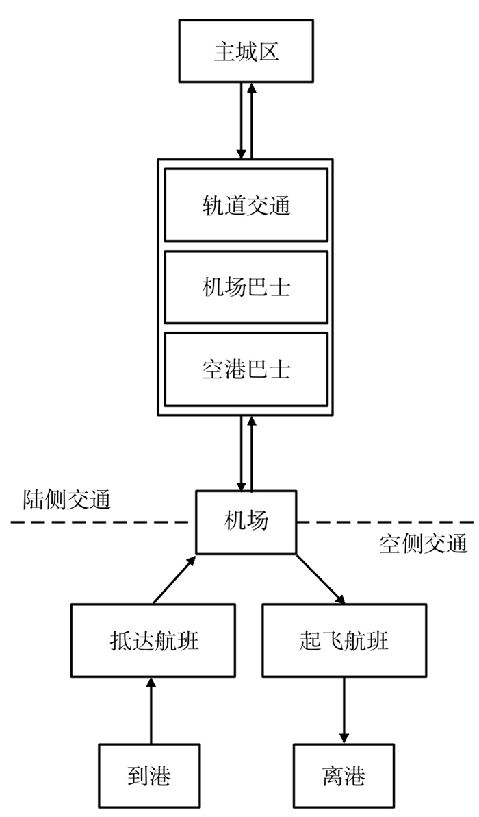
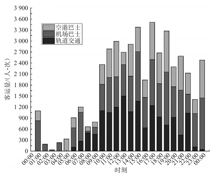
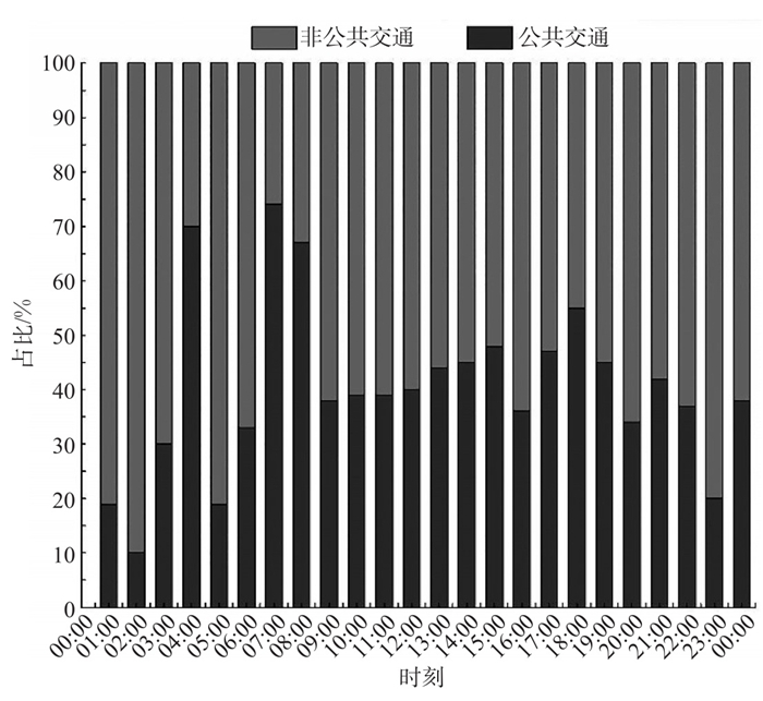
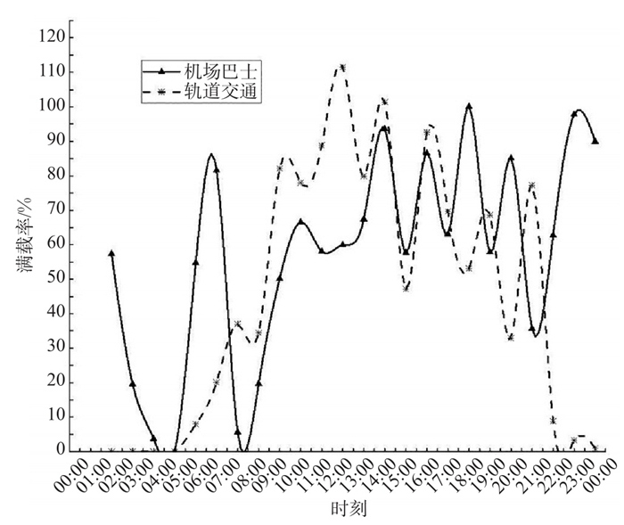
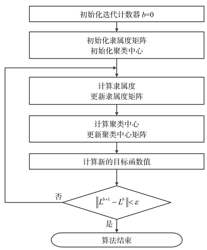
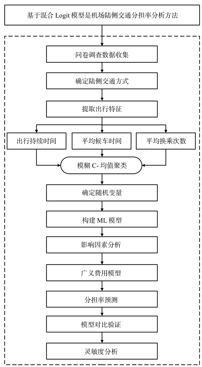
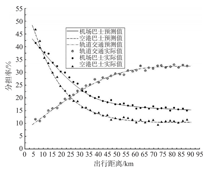
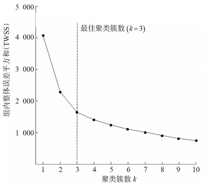
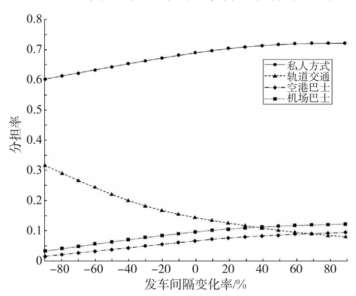
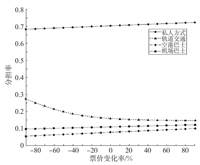
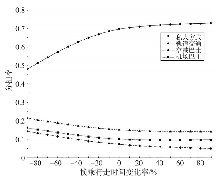
Scientifically predicting the share rate of high-capacity public transportation on the airport landside can provide quantitative support for the scale and capacity allocation of landside transportation facilities. Existing methods often have difficulty effectively depicting the significant differences in factors such as travel time value, travel purpose, and tolerance for transfers among travelers. Prediction results usually have issues such as being biased towards the average and lacking accuracy. Based on the analysis of the characteristics of public transportation passenger flow, this study takes into account the individual heterogeneity of travelers and develops a mixed logit generalized cost (MLGC) method for public transportation share rate by combining the mixed logit (ML) model with the generalized cost model. The fuzzy c-means (FCM) algorithm is used to select travel duration, average transfer times, and average waiting time as features. Based on the elbow rule, landside travelers are clustered into three heterogeneous groups. Taking travel time and travel cost as random variables, the parameters are classified into 4 specific attribute parameters according to private mode, rail transit, airport bus, and airport shuttle bus. Each variable is processed for binary classification. Meanwhile, elements such as perception of travel, waiting perception, and crowded environment are incorporated into the generalized cost function to construct a transfer impedance coefficient that includes spatial semantics. In addition, a three-level testing system was established, and model comparison and verification were carried out based on the Akaike information criterion (AIC) and log-likelihood values. Taking the Capital Airport as the empirical object, the model is calibrated using 2 067 valid questionnaires. The results showed that the McFadden value of the MLGC model reached 0.255, the fitting coefficient R2 is 0.924, and the log-likelihood value and AIC perform better than others. Sensitivity analysis indicates that when the train interval is reduced by 70%, the share rate increases to 26%, and when the transfer travel time is reduced by 90%, the overall share rate of public transportation exceeds private transportation. Moderately lowering ticket prices could significantly enhance the competitiveness of rail transit. The MLGC model can effectively reveal the influencing mechanism of the impact of airport landside public transportation choices. Reasonable train intervals, optimized ticket pricing mechanisms, and convenient transfer conditions can significantly increase the share rate of public transportation.
Roadside Unit Deployment Optimization Based on Mixed Traffic Stochastic Equilibrium
ZENG Minghua, HE Jing, YANG Xiaoguang
2026, 44(1): 181-188. doi: 10.3963/j.jssn.1674-4861.2026.01.016
Abstract(48) HTML (18) PDF(2)
Abstract:
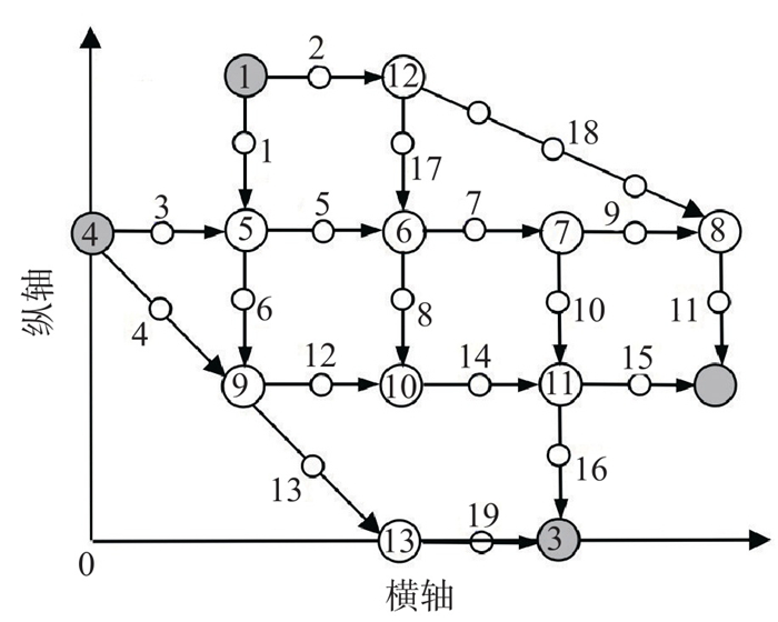
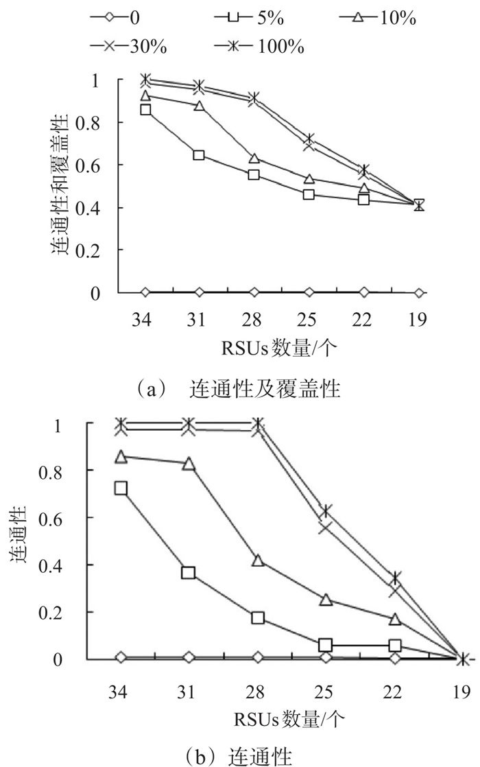
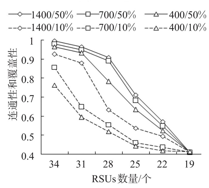
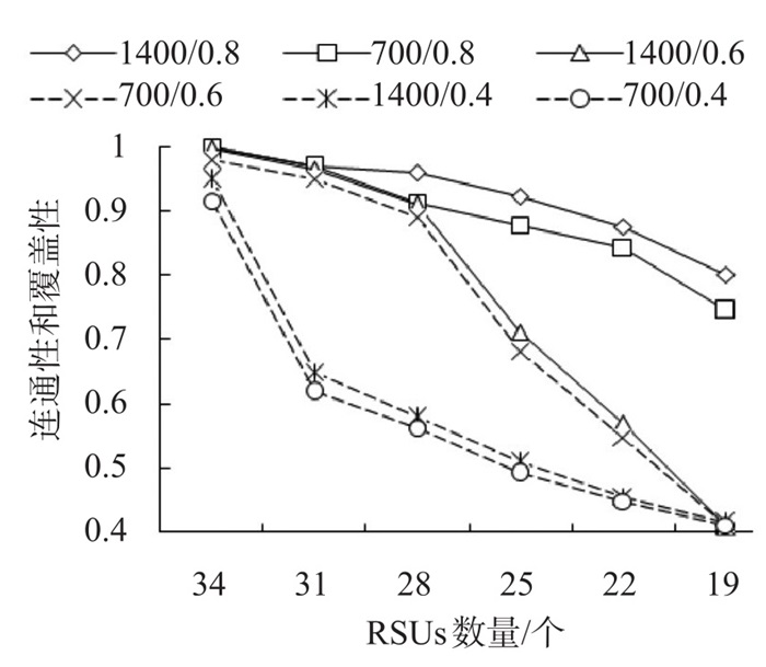
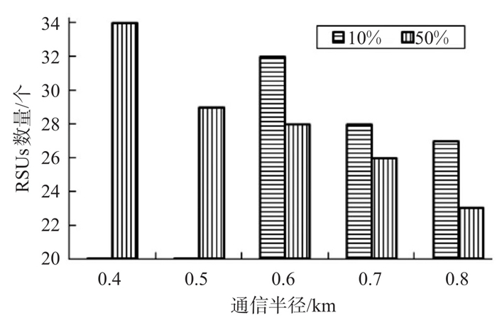
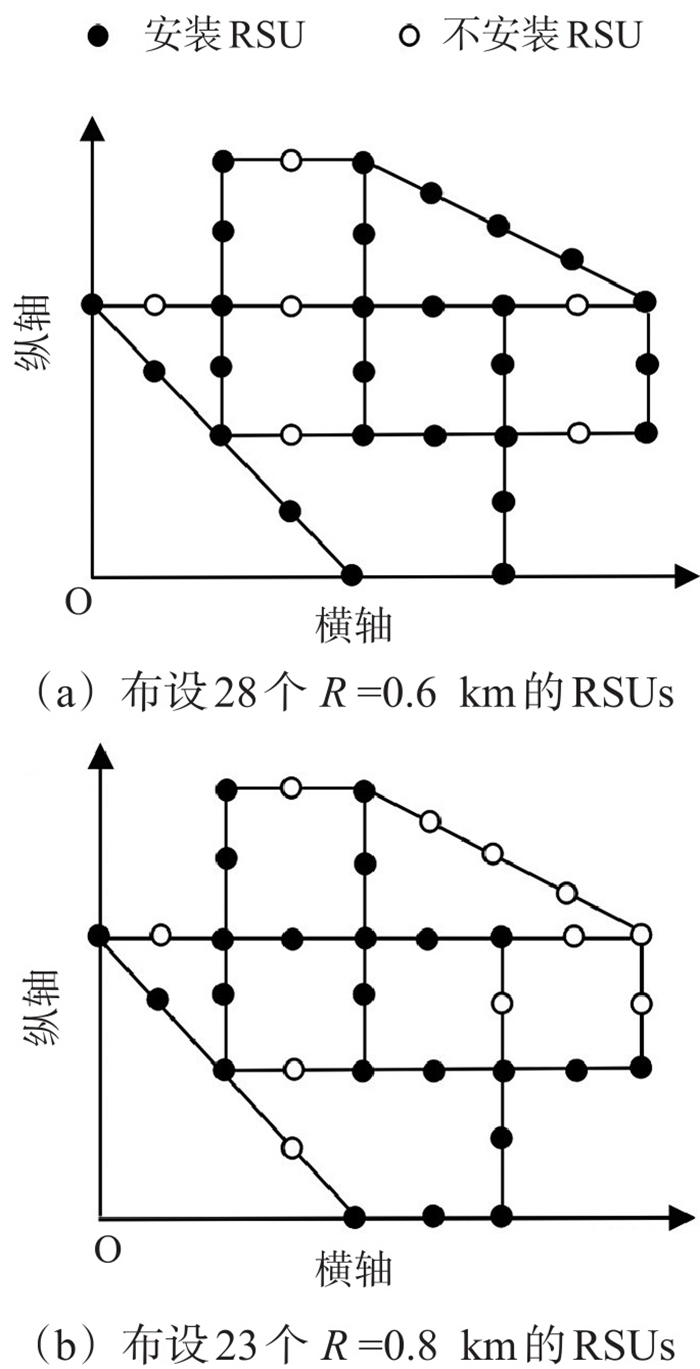
Existing studies on roadside unit (RSU) deployment insufficiently consider mixed traffic scenarios involving autonomous vehicles (AVs) and human-driven vehicles (HVs), making it difficult to ensure the connectivity and coverage of vehicular ad hoc networks (VANETs). To enhance VANET performance, research on RSU deployment under the impact of stochastic route choice of mixed traffic is conducted. To depict the route choice behavior of AVs, an improved path-size logit model is proposed based on communication probability, and a stochastic user equilibrium (SUE) mathematical programming model is established for mixed HV and AV traffic. Considering the impact of the mixed traffic with AVs and HVs on the RSUs deployment, a weighted objective function is designed to comprehensively considering both communication probability and coverage and establish a bi-level programming model for RSUs layout optimization with the aforementioned SUE mathematical programming as the lower-level model. An improved binary particle swarm optimization algorithm incorporating a speed monitoring strategy is designed to solve the bi-level model. Numerical experiments yield the following finds. ①The proposed model and algorithm are feasible and effective and can achieve, for different traffic demands, optimal deployment schemes with network connectivity and coverage greater than 90% and with balanced number of RSUs and communication radius. ②When AVs modal share exceeds 5%, optimized RSU deployment enables VANETs to achieve relatively high connectivity and coverage. ③With a large communication radius of 0.8 km, connectivity and coverage decrease slowly as the number of RSUs varies within the range of 19 to 34 but remain at a high level. With a communication radius of 0.6 km (0.4 km), connectivity and coverage decline slowly at first and then significantly (significantly at first and then slowly) and finally approach a low value of 0.4. ④A lower AV modal share incidates a greater marginal impact of total demand of mixed AV and HV traffic on connectivity and coverage.